When most people think about trekking in Peru, what comes to mind are often the treks to Machu Picchu, the iconic Incan citadel that is now the principal tourist attraction of Peru, if not South America as a whole. These treks include the classic four-day Inca Trail and the popular Salkantay trek.
However, since Adelle and I have already visited Machu Picchu when Adelle’s parents came over to visit us in Peru last month, we wanted to do a multi-day trek that did not culminate in Machu Picchu. After some online research, we decided to sign up for a five-day trek with Peru Hike that would take us around the mountain of Ausangate (6,380m above sea level)—one of the tallest mountains in Peru and regarded as sacred by the indigenous Quechua-speaking communities who have lived around it for centuries. This particular trek also included a detour to see Vinicunca, another mountain more commonly known as Rainbow Mountain due to its colourful mineralogical composition.
Despite having to deal with the high altitude, cold and daily rains, we still consider Ausangate the best trek we have done not just on our travels thus far, but in our lives (even considering other treks that we did separately in the past). I hope that the series of photos below can help convey why:
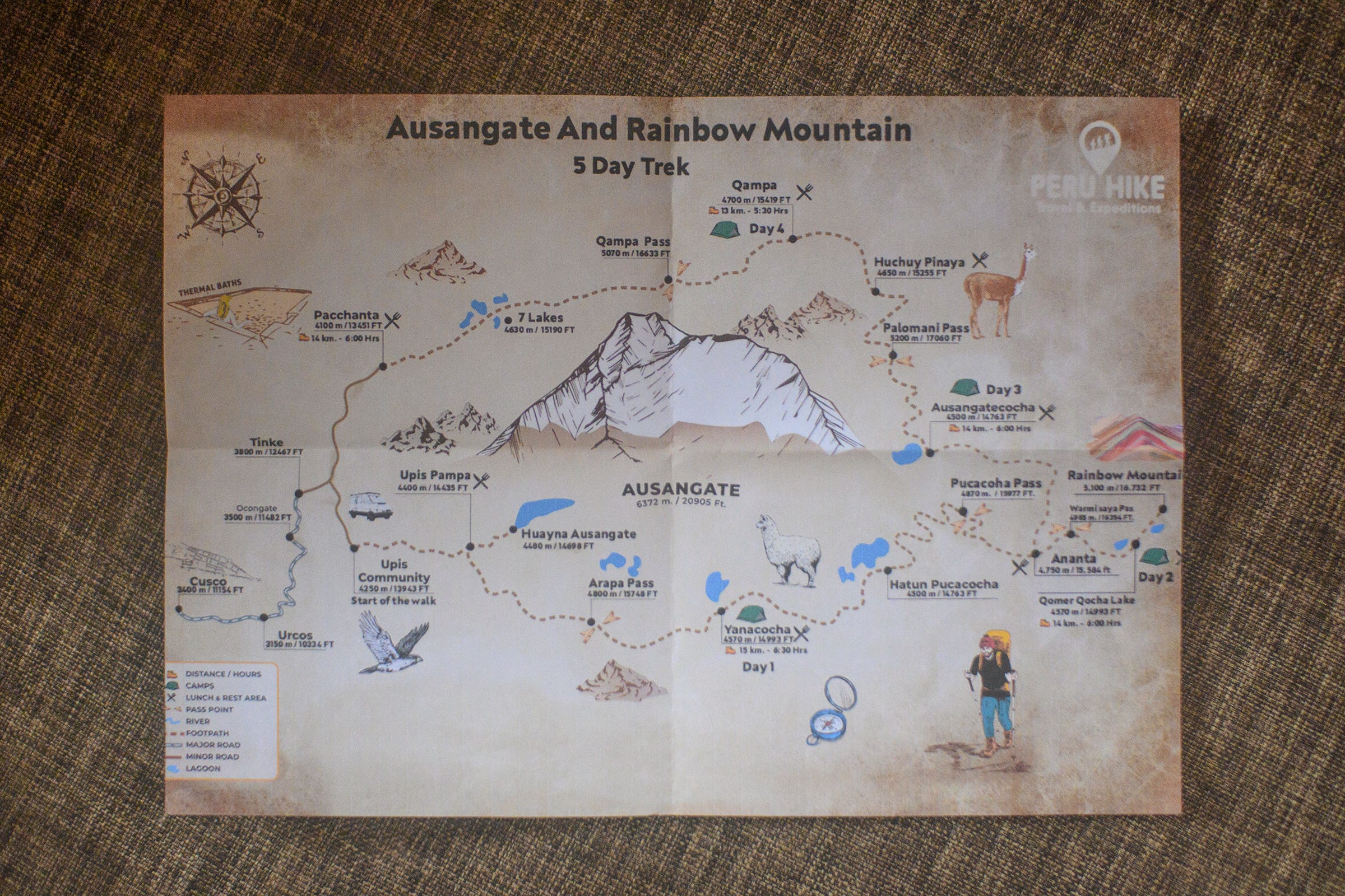
Our trekking company, Peru Hike, gave us this infographic detailing the key information about our five-day trek. On average, we covered about 14km (~6 hours of walking time) and crossed 1-2 mountain passes each day. We started the trek at Upis village (4,250m above sea level) and ended it in the town of Pacchanta (4,100m). The highest point along the trek was Palomani Pass (5,200m), which we crossed on the fourth day. We also camped at an elevation of at least 4,500m every night.
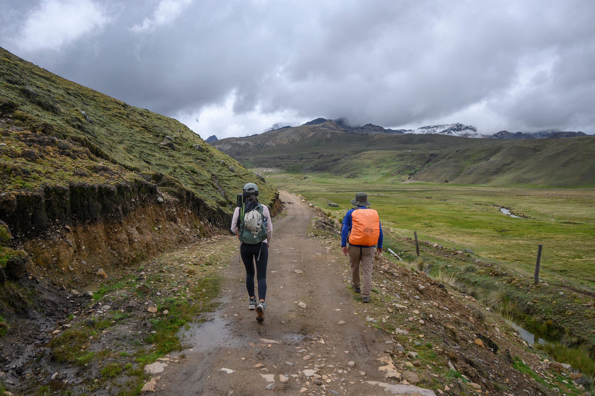
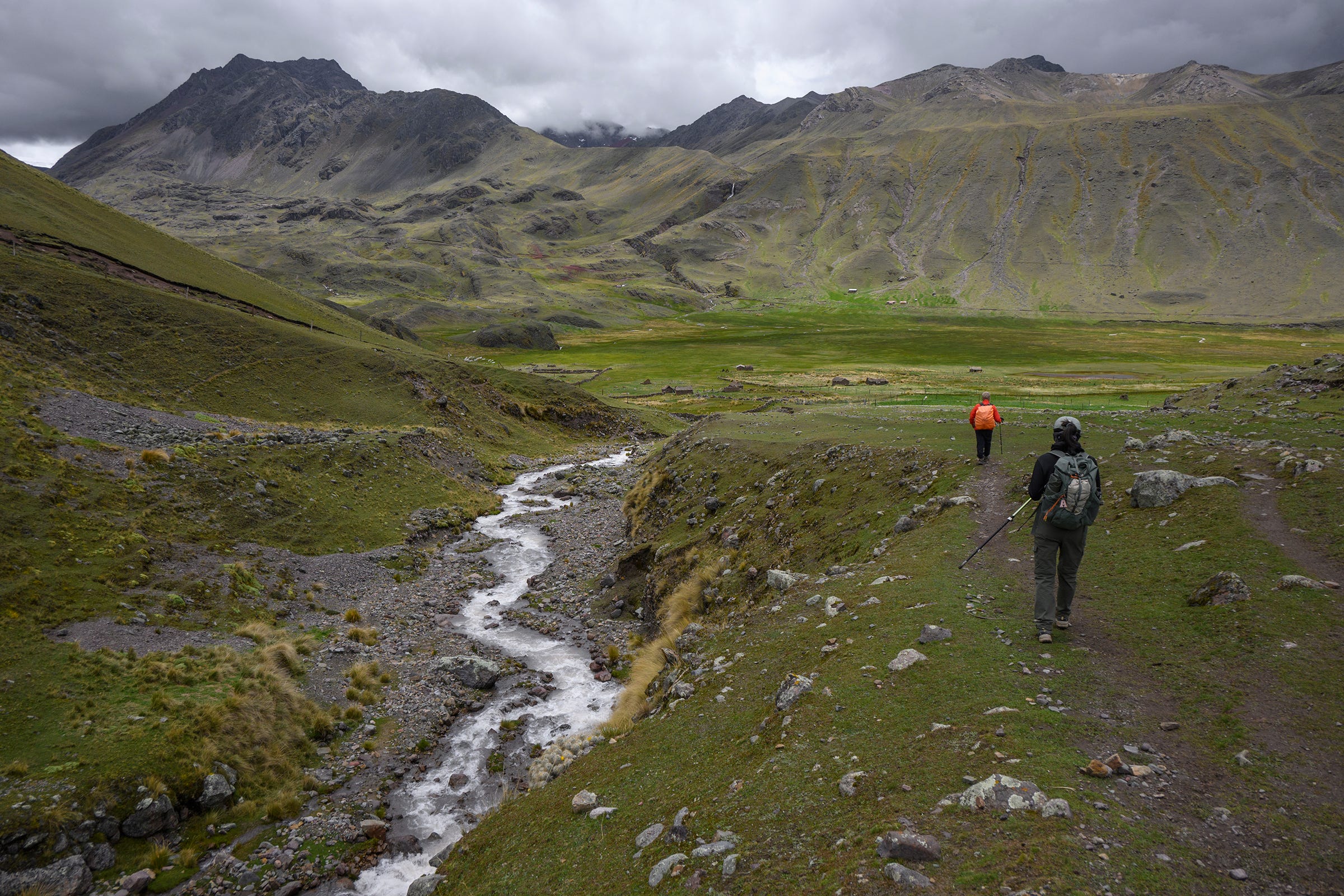
Starting the trek along a dirt road that led from Upis village to the Upis campsite, which was where we had lunch on the first day. Richard, our guide from Peru Hike, actually hailed from Upis campsite, where his family lived. Hence, he was intimately familiar with the entire area, and our experience with him felt similar to a friend showing us around his backyard (a very large one at that).
Waiting for lunch to be served at the home of Richard’s family. They even have a small private hot spring at the back of their house!
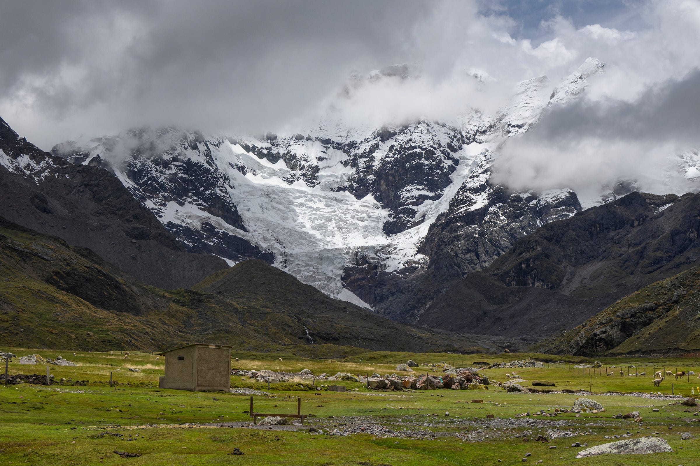
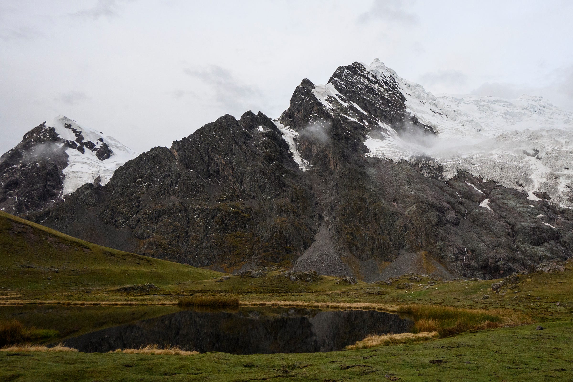
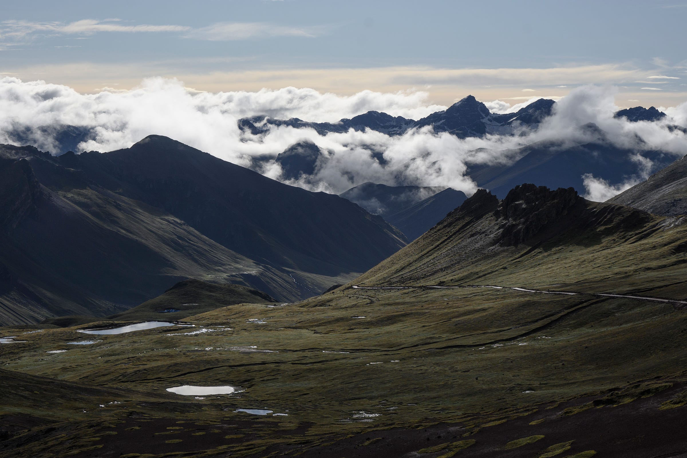
View of Ausangate from the Upis campsite. Unfortunately, the peak of Ausangate was obscured by clouds, which was a common occurrence during the wet season that commences around November every year (we did this trek from 28 November - 2 December). Nonetheless, seeing its gigantic glaciers provided a nice teaser for all the majestic scenery we were about to witness over the next five days.
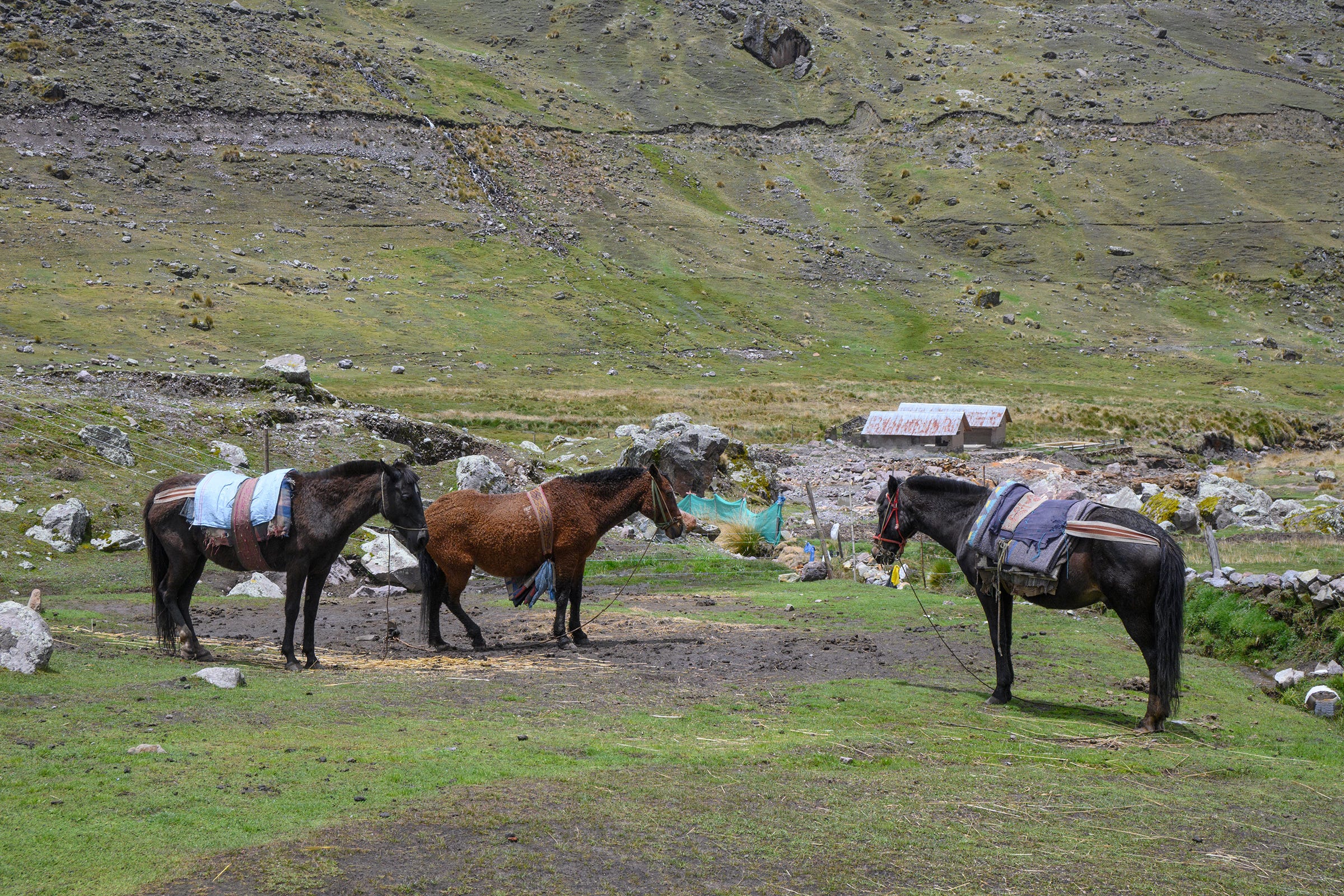
This trio of horses supported our trek, carrying all our supplies including our tents, cooking equipment, food and some personal items. Peru Hike provided us each with a small duffel bag for our personal items (up to 8 kg), which was carried by these horses. This helped to lighten our load considerably, such that we only needed to carry with us some water and our necessary clothing (e.g. ponchos and warm clothing) during the trek. According to our guide Richard, although mules are stronger, horses are used to carry supplies on this trek (and up to 5,800m) as they handle the altitude better.
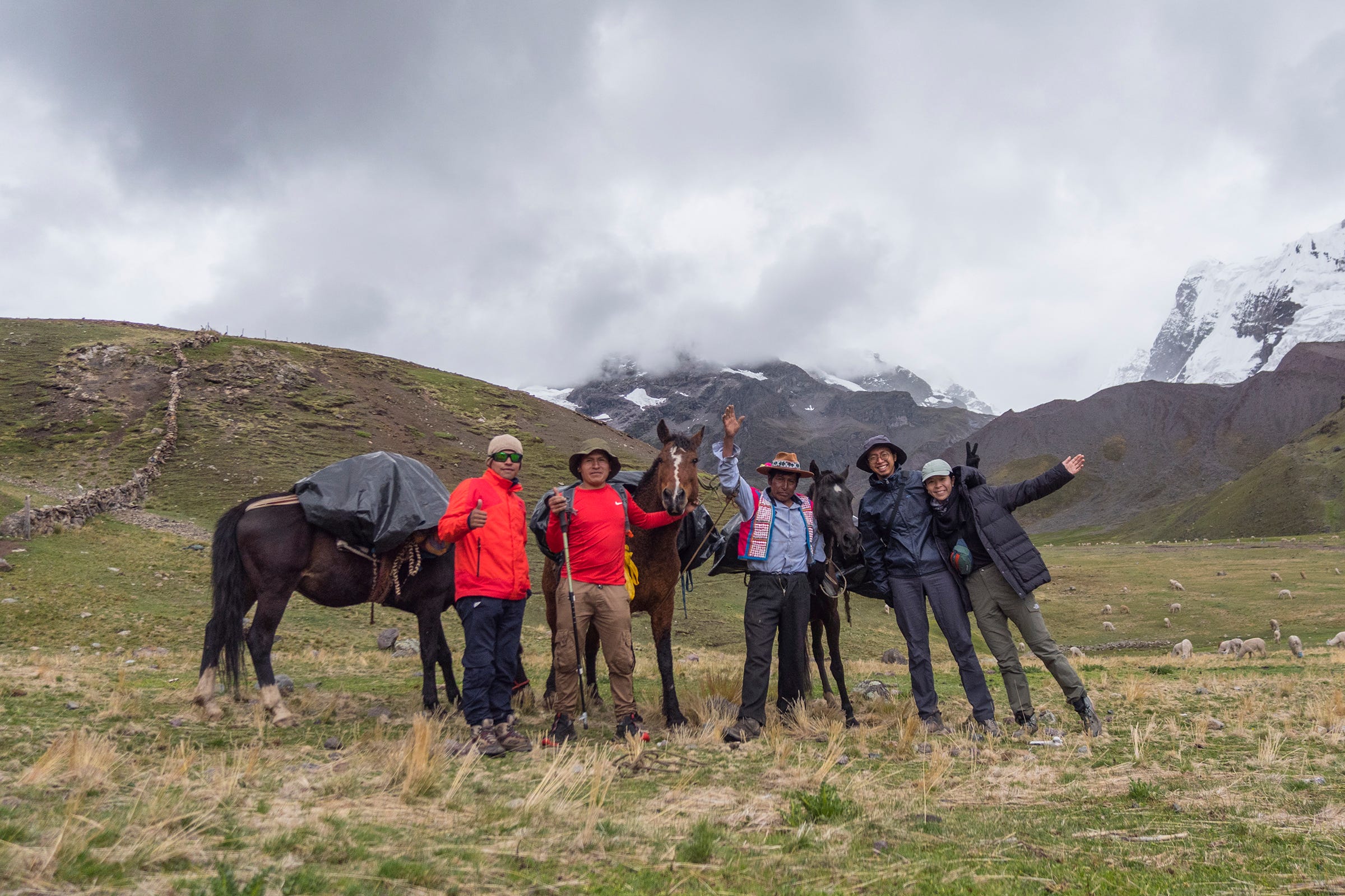
Group photo of our entire trekking team, with Richard (our guide), Wilber (our chef), Juan (our horseman) and his three horses.
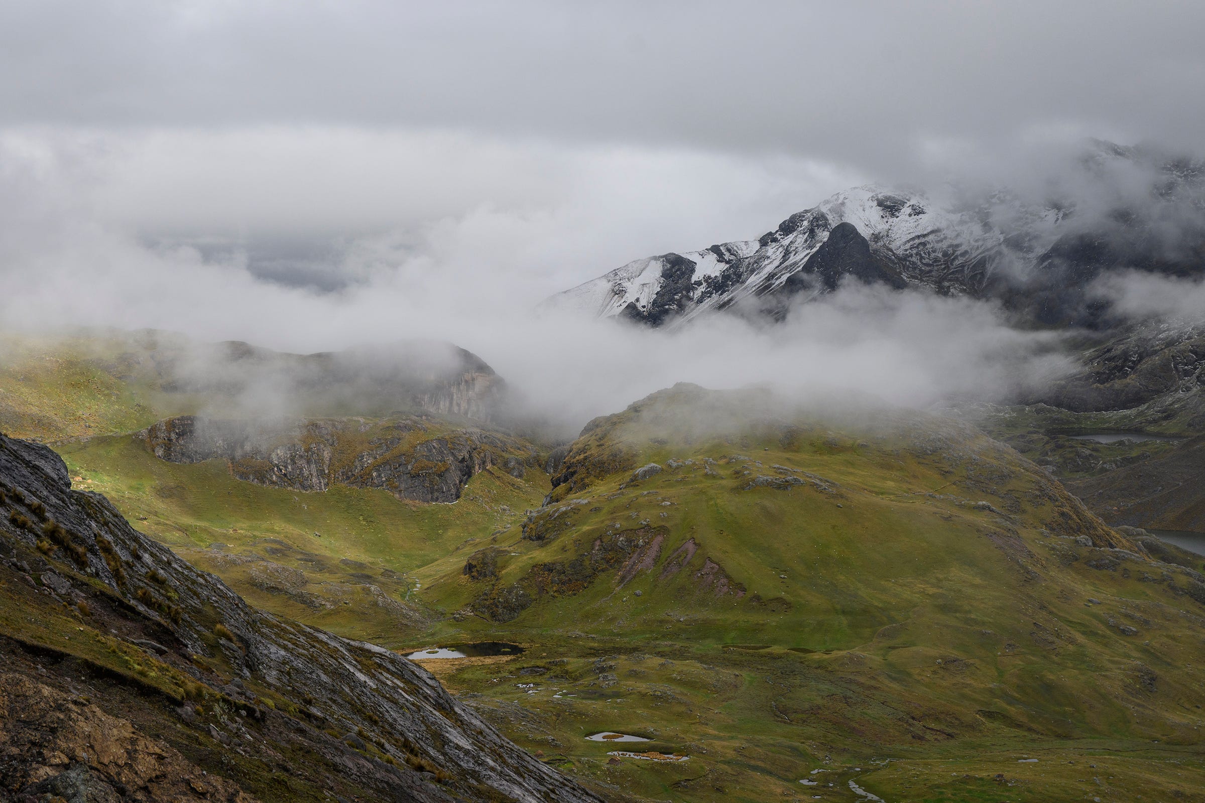
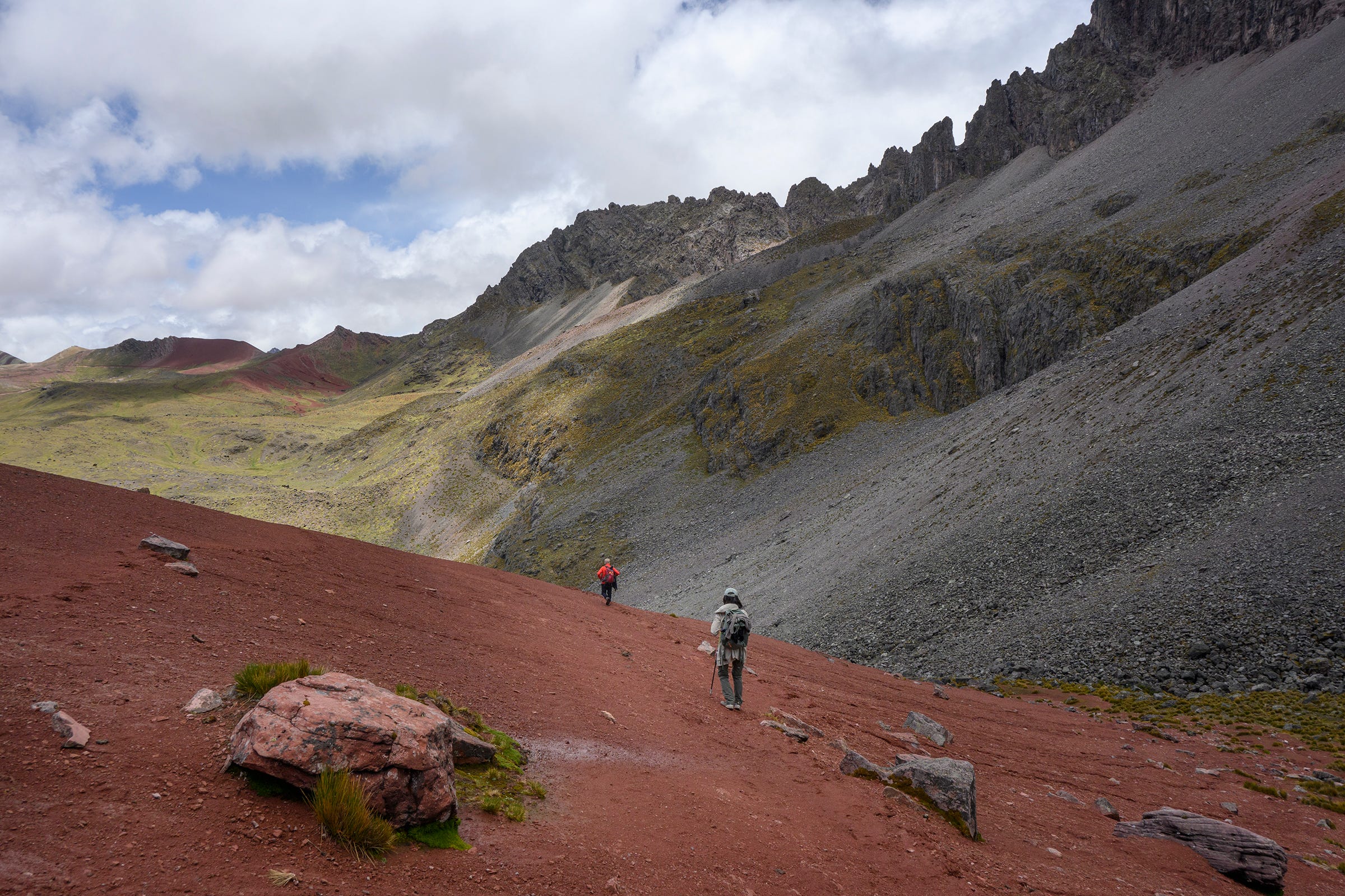
Shortly after we resumed trekking post-lunch on the first day, we were caught in a thunderstorm. Braving the hail, snow and rain, we trudged on and crossed our first mountain pass, Arapa Pass (4,800m). Thankfully, the storm subsided while we descended and we were greeted with snow-covered landscapes all around. Unfortunately, our hiking boots and socks got wet (from the rain and melted snow running down from our pants) and our feet got really cold whenever we were stationary.
Our first campsite at Yana Qocha (which means “black lake” in Quechua), with a view of Ausangate from the southwest.
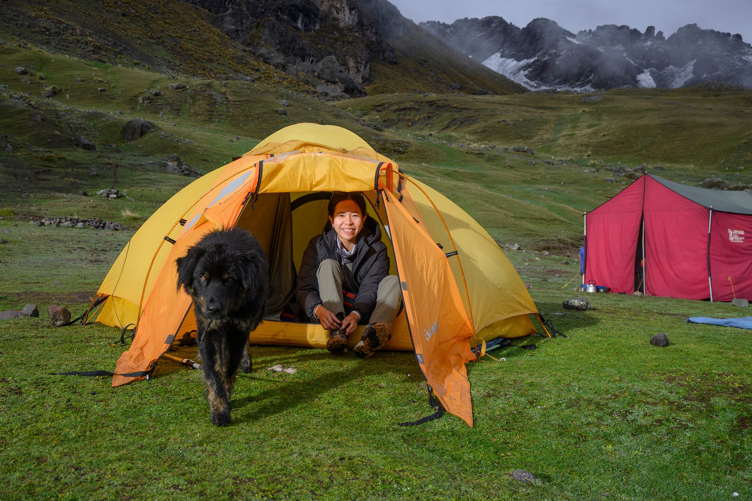
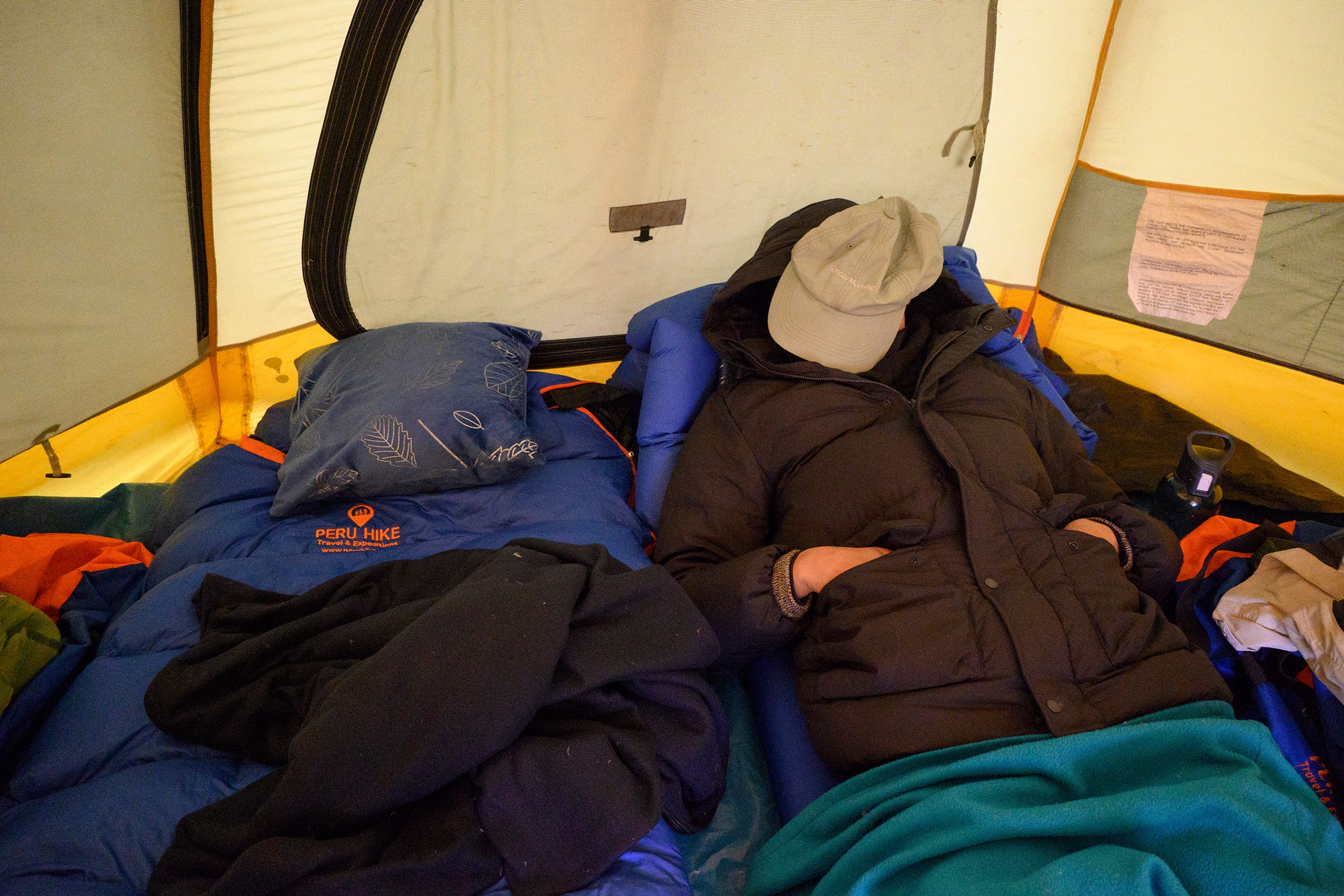
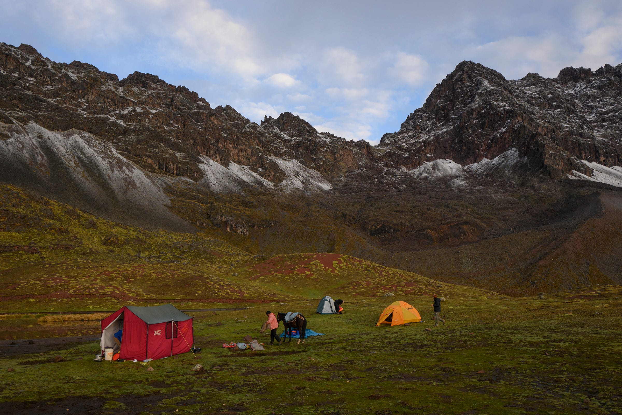
Peru Hike provided the two of us with a comfortable four-person tent which had lots of space for us to put our personal belongings. Wilber and Juan also helped us to set it up every day, as they would usually reach the campsites ahead of us. The red tent in the background was the tent for the kitchen and dining area, and was where Wilber and Juan slept in each night. According to Richard, the black dog here didn’t belong to anyone and liked to roam freely around the area.
Besides the tent, Peru Hike also provided us with thick sleeping bags, blankets, an air-filled sleeping pad for insulation and comfort, and even pillows. We also received a pouch filled with hot water every night for warmth. The nighttime temperature during our trek was around 2–5°C, so we appreciated every one of these little perks to keep us warm!
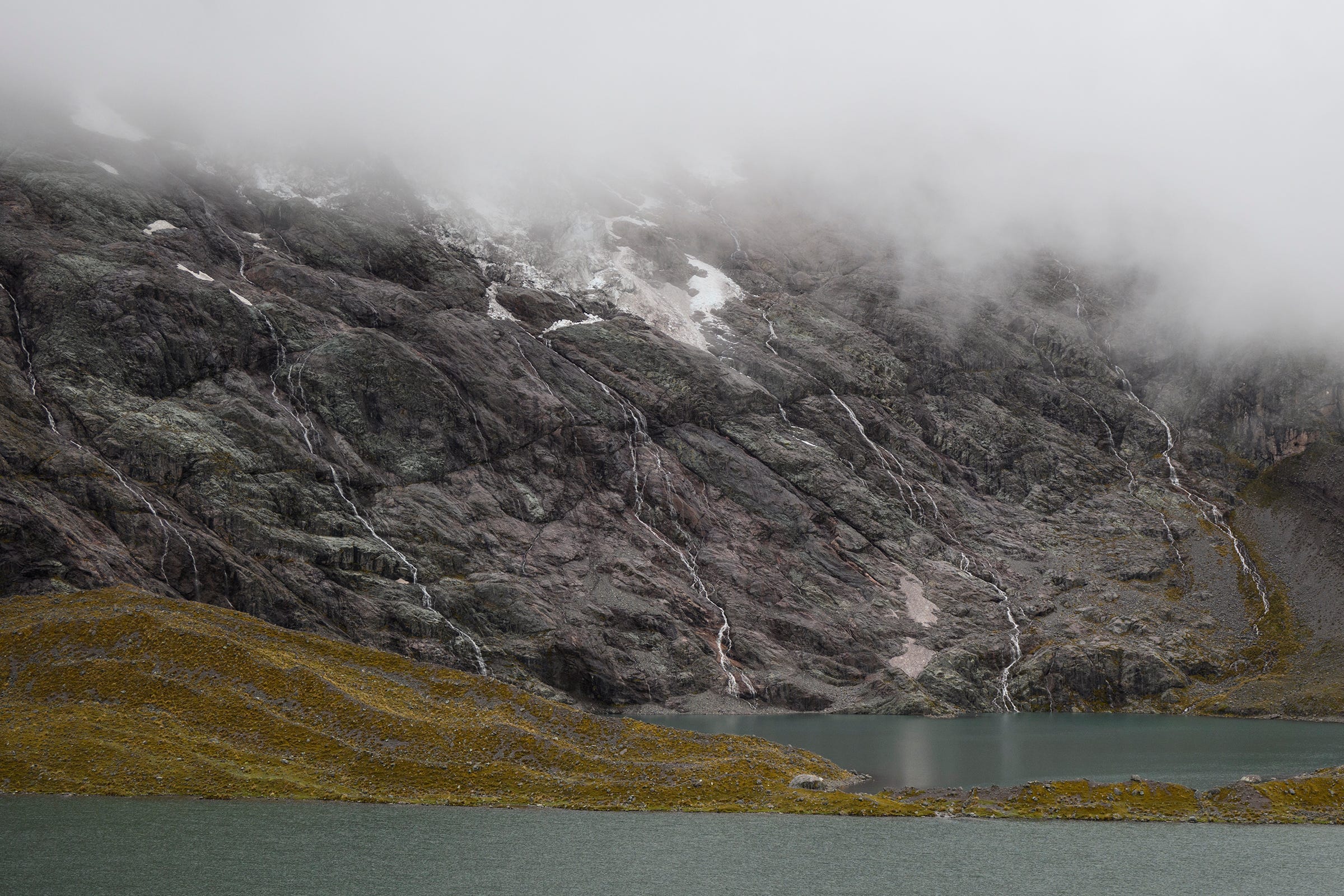
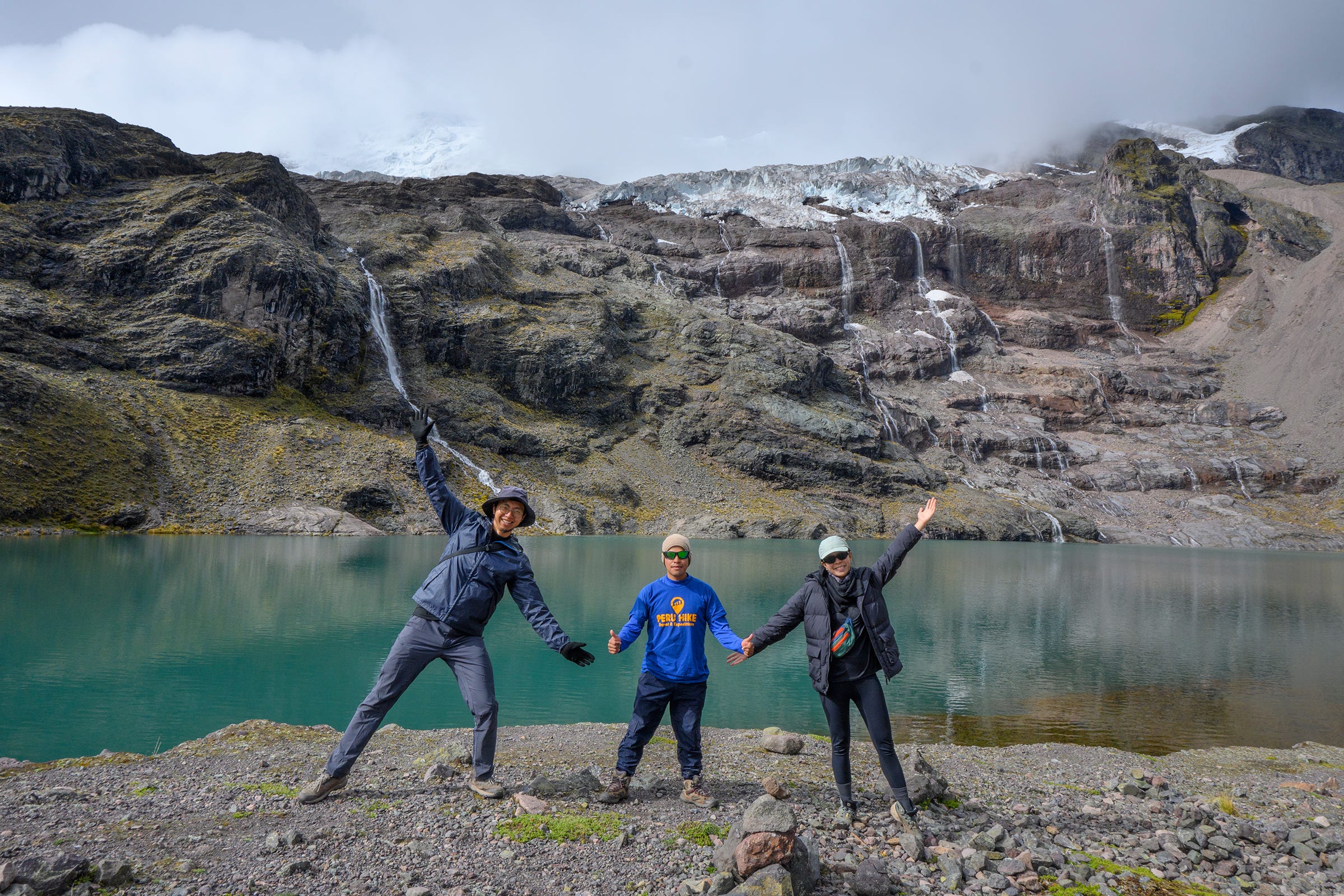
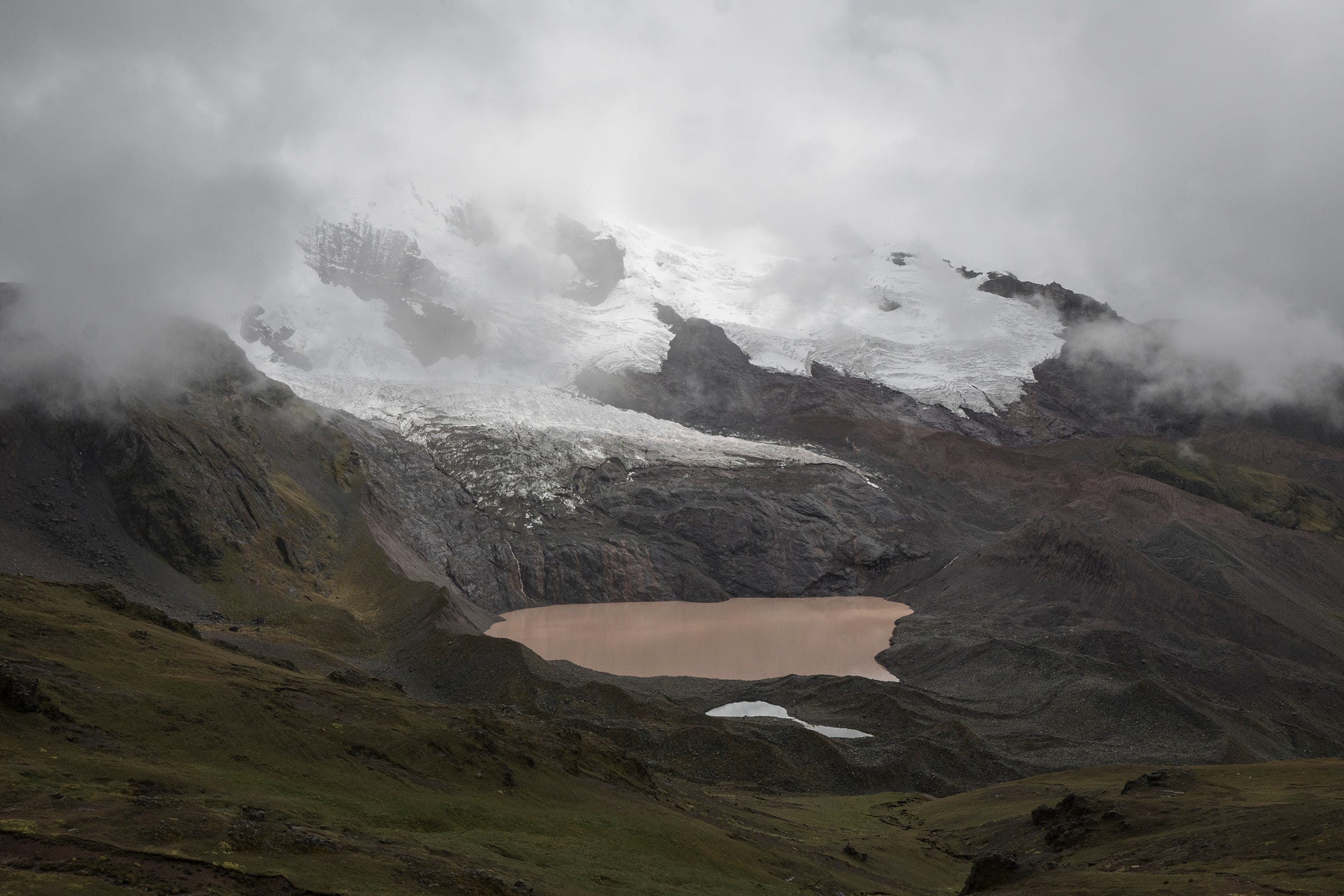
One of the most picturesque sights along the trek was seeing the glaciers of Ausangate up close, and their meltwater streaking down the rock surface into beautiful blue lagoons of water. This photo here was taken at Hatun Pucacocha (“big red lake” in Quechua) just before we settled in for our first night.
View of Hatun Pucacocha as we embarked on the ascent to Pucacocha Pass (4,870m) on the morning of our second day. The meltwater (as seen in the previous photo) seemed to have disappeared, probably due to freezing temperatures during the night.
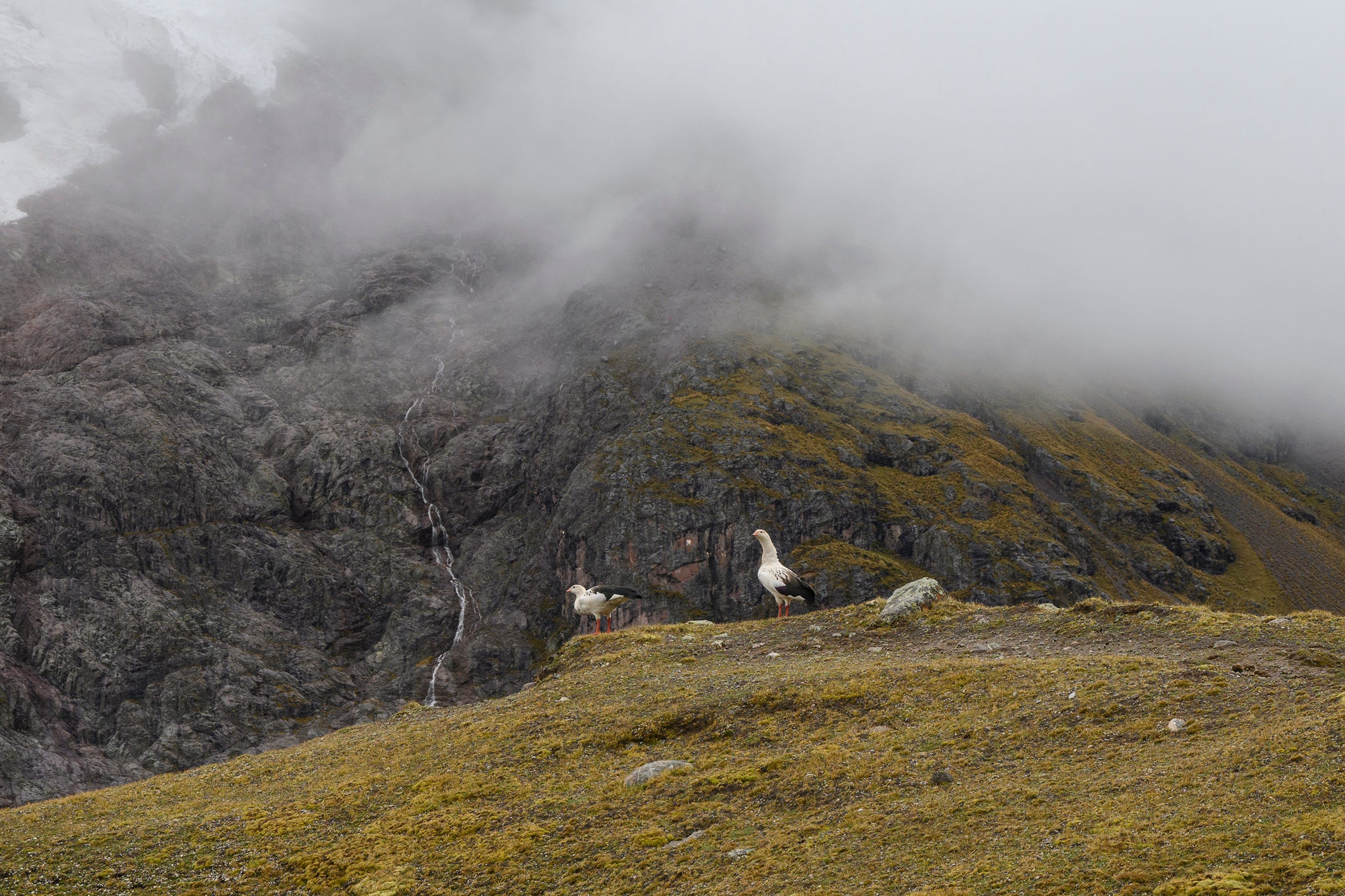
It was common to spot pairs of Andean goose during our trek. These birds form strong pair bonds that last for life or several years, with both parents participating in the care and protection of their offspring.
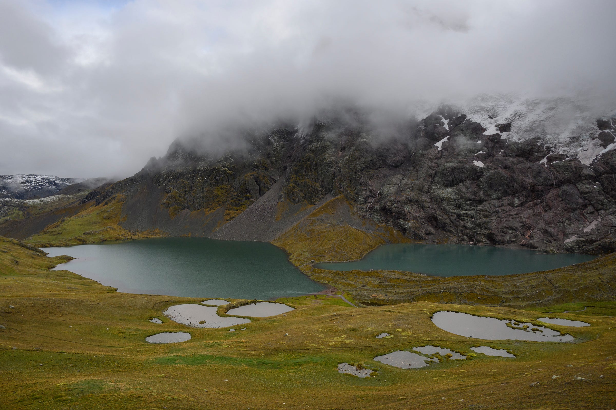
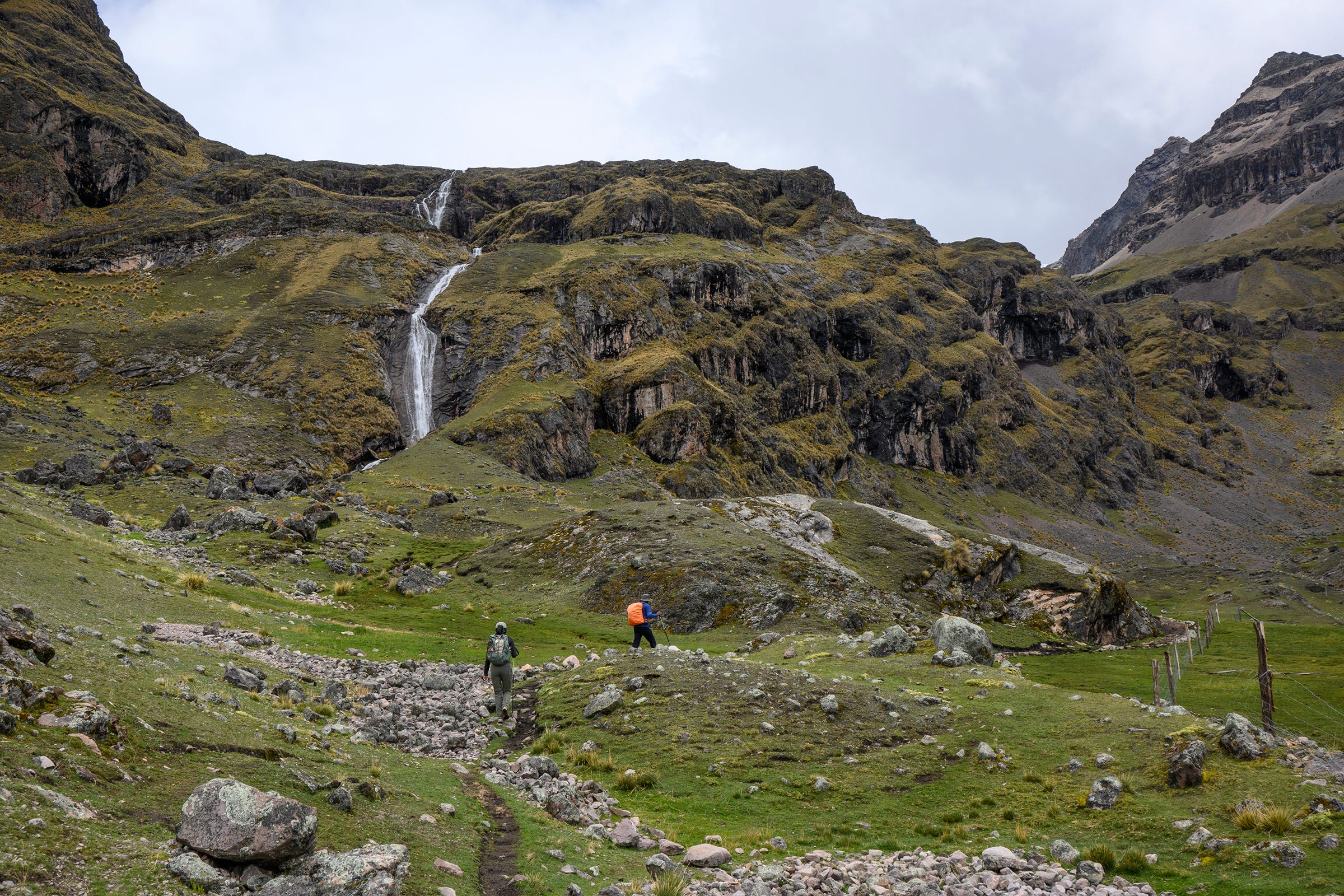
More breathtaking views as we continued our ascent to Pucacocha Pass.
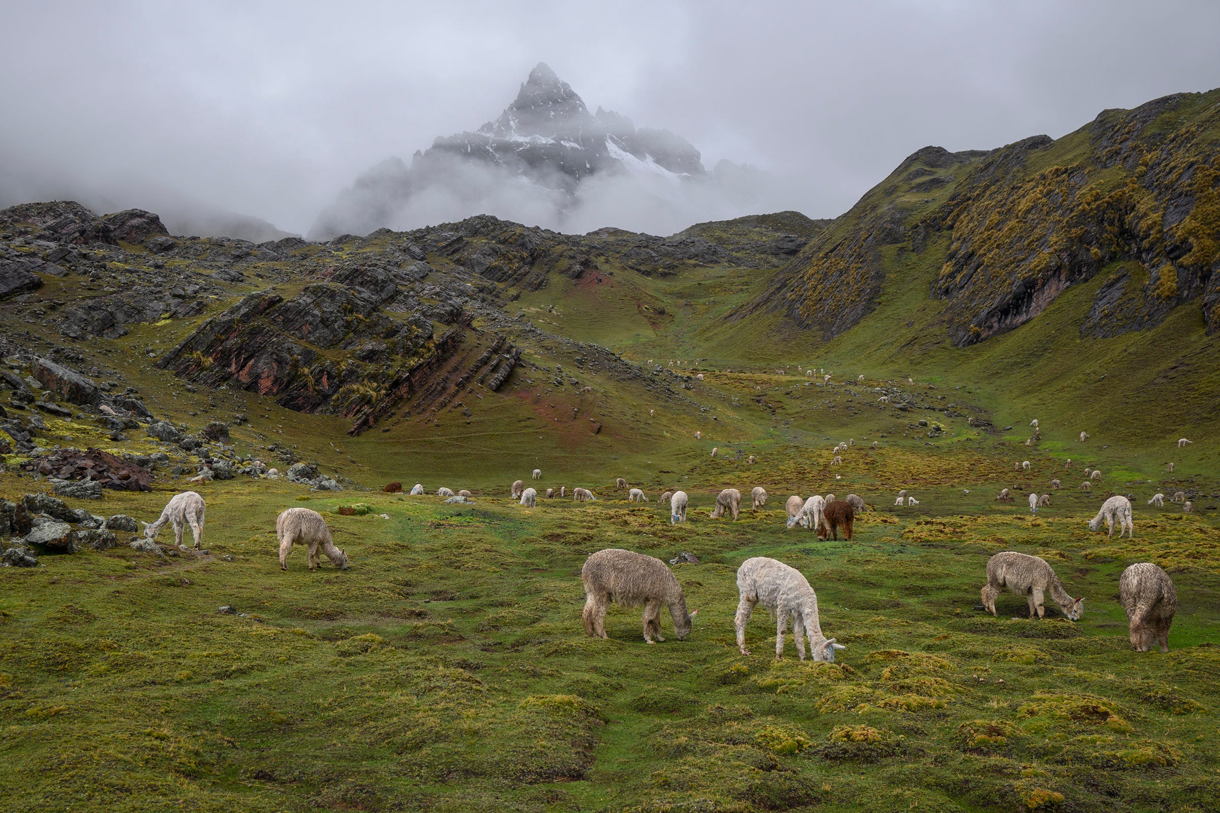
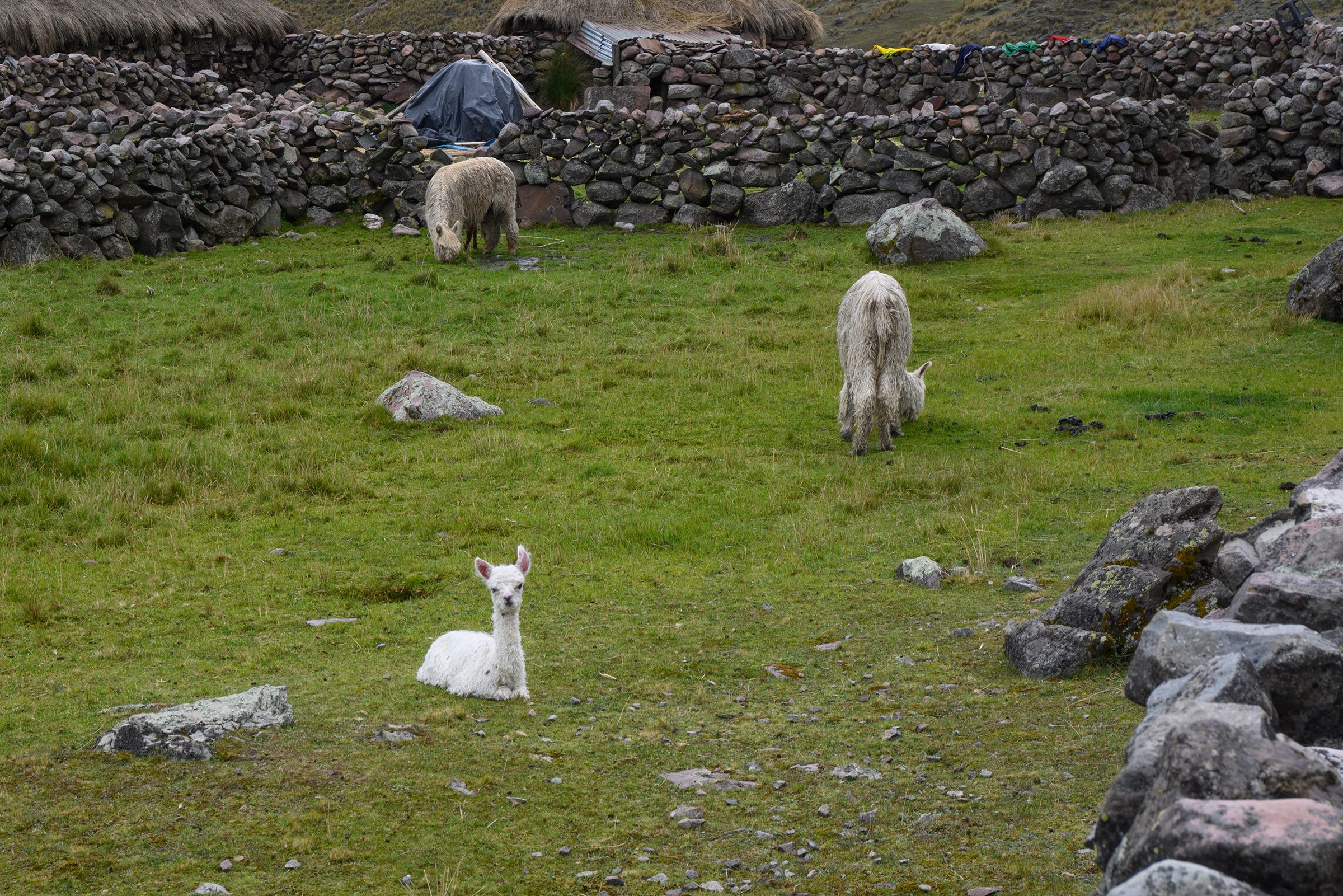
On the descent from Pucacocha Pass, it started raining and we sought shelter in a hut near the home of a local lady. I took this photo of her alpaca herd grazing calmly behind the hut as the rain started to peter out. As we would observe over the next few days, rearing alpacas (for their wool and/or meat) appeared to be the principal source of livelihood for the people living around Ausangate. Based on Richard’s conversation with the lady, she could sell a live alpaca for around 300 soles (~108 SGD / 80 USD).
We passed by the scenic Ananta campsite on the way to Warmisaya Pass (4,985m) on the second day. The orange buildings are part a newly-constructed lodge, which —as Richard explained to us—hasn’t started operating yet due to some ongoing disputes between the owner and the locals living around the campsite.
Richard introduced us to the pupusa while we were ascending Warmisaya Pass. Native to the Andes, the pupusa only grows at very high altitudes and has medicinal properties, often used by the indigenous communities to treat stomach-related problems. It is consumed as a sort of tea, by steeping it in boiling water and drinking the resultant infusion. Adelle gathered a few pieces and we got the chance to try drinking the pupusa infusion at our second campsite. It has a strong herbal flavour which we both quite liked.
View from Warmisaya Pass (4,985m). The word “warmi” means woman in Quechua, and Richard explained that the pass was named after the fact that the surrounding lands were said to be populated by only women a long time ago. The Ananta campsite can also be seen on the right side of the photo.
Descending from Warmisaya Pass and heading towards our second campsite at Qomer Qocha.
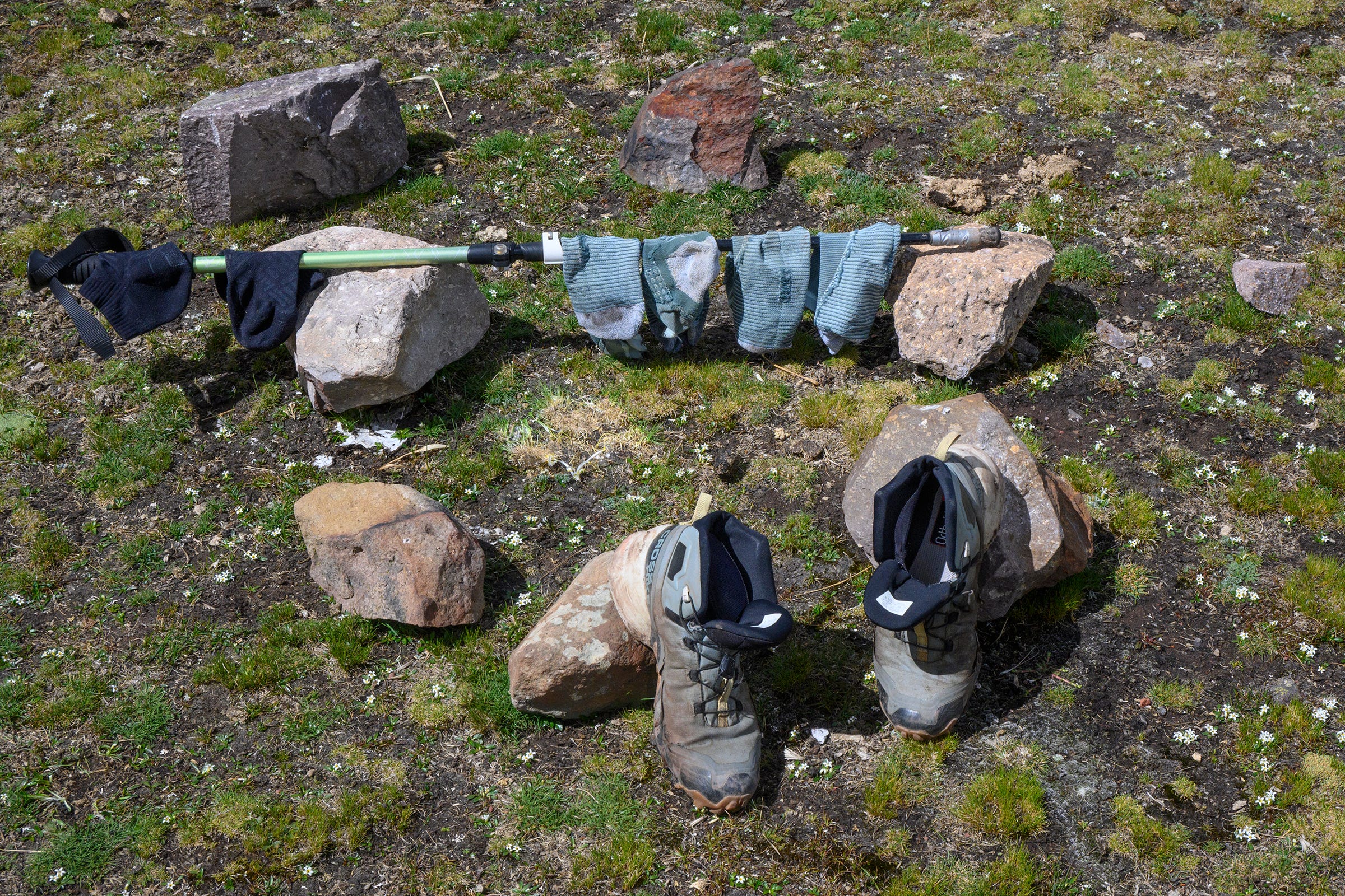
There was a nice patch of sunny weather after we had lunch at our second campsite and had the whole afternoon to relax. We took the opportunity to sun our damp socks and boots, and they were nearly dry by the end of the day!
After a night of rain, we woke up to find the mountains around us partially covered in snow. Days on the trek started with some hot tea at 5am and breakfast at 5.30am. I snapped this photo of our second campsite just before we left to go to Vinicunca, located about an hour’s walk away.
View of Ausangate from our second campsite. Although the peak itself is obscured by clouds, we could at least see the morning sun illuminate the part of the mountain that is permanently covered by snow. Warmisaya Pass is also visible on the left side of this photo, just above the shadow cast by the mountain in the foreground.
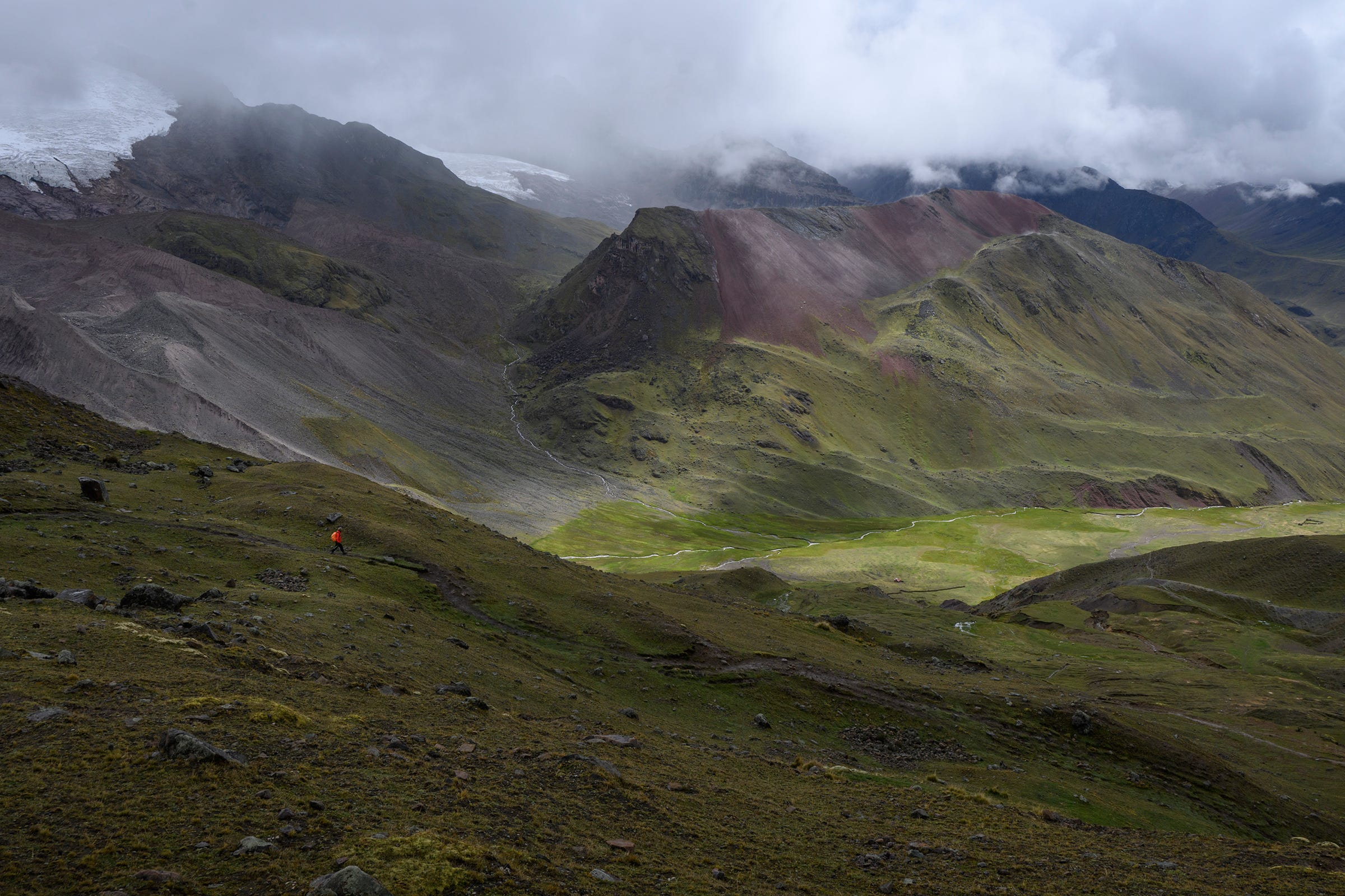
The walk to Vinicunca from Qomer Qocha campsite was also very scenic!
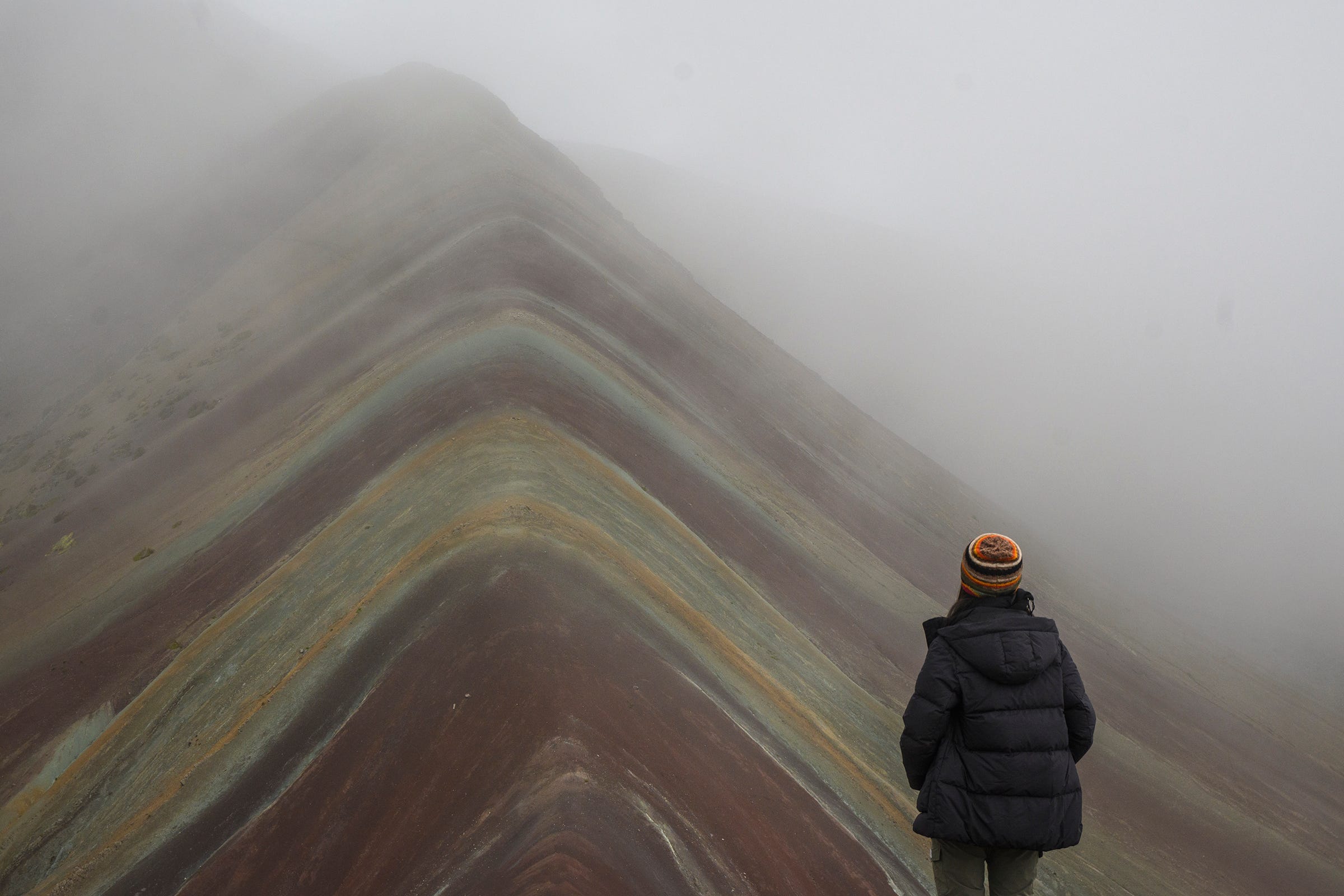
When we arrived at Vinicunca (5,100m), the entire mountain was shrouded in fog. Thankfully, after a short wait of ~20-30 minutes, there was a short break in the fog which allowed us to take photos, just before the hordes of day trippers from Cusco started arriving. Richard explained that Vinicunca was discovered by a local guide (after the snow on the mountain started melting away due to global warming) and the site was opened for tourism sometime in the mid-2010s. Over the past decade, Vinicunca has grown to become one of Peru’s most popular tourism destinations, as many sought to take photos with its iconic colours, the result of layers of different minerals squished together in the rock.
Climbing the Warmisaya Pass again after our detour to see Vinicunca, this time to get back to the Ananta campsite, from where we’ll continue on the classic Ausangate circuit.
We passed by this enclosure holding a herd of alpacas while on the way from the Ananta campsite to our third campsite at Ausangatecocha. Richard mentioned these alpacas were kept within the enclosures in preparation for mating.
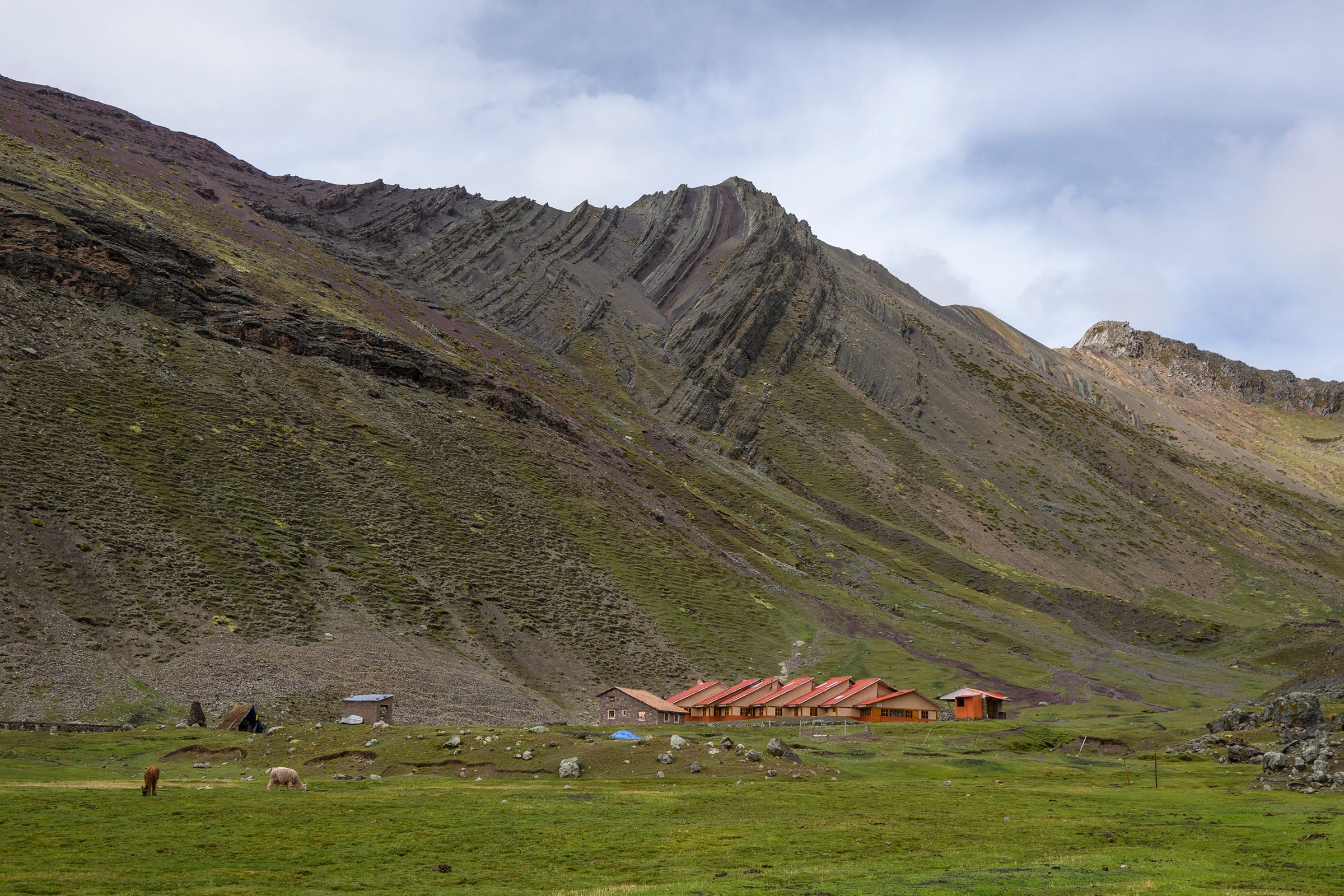
According to Richard, the “boss” of the Ausangatecocha campsite has set up a Starlink service, allowing him to offer WiFi to users of the campsite from the building pictured in this photo. Unfortunately, the WiFi is only available during the peak tourist season, which coincides with the dry season from around May to October.
Photo with Richard at Ausangatecocha, easily the most beautiful of the four campsites we stayed at during the trek. A large lake with clear blue waters, with a gigantic glacier and numerous waterfalls of meltwater as a backdrop—what’s not to love?
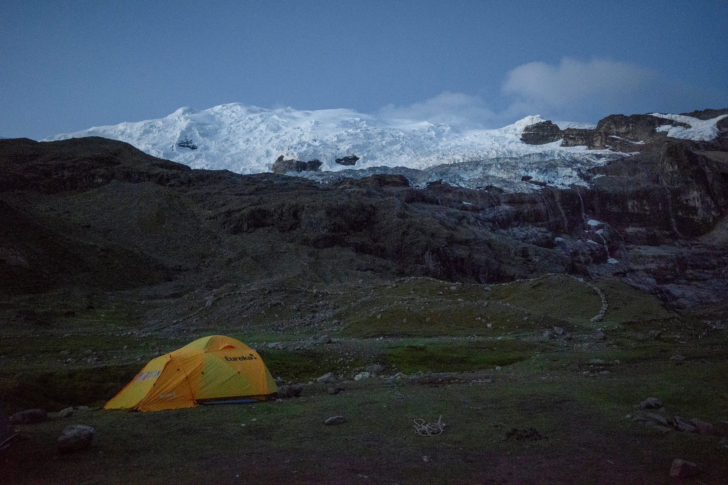
Our tent at the Ausangatecocha campsite with the imposing Ausangate as the backdrop. As the sun set, dinner time beckoned! Our chef, Wilber, constantly surprised us with the amazing meals he whipped up, which always included a bowl of piping hot soup and generous servings of a protein, vegetables and carbohydrates. Some of the highlights for me included lomo saltado (stir-fried beef and potatoes), chaufa de quinoa (fried quinoa) and stir-fried mushrooms (see below).
Wilber and Juan harvested some wild edible mushrooms along the trek. Apparently they grow readily in the mountains during the rainy season. Wilber stir-fried the mushrooms for our dinner on the third day and they were delicious!
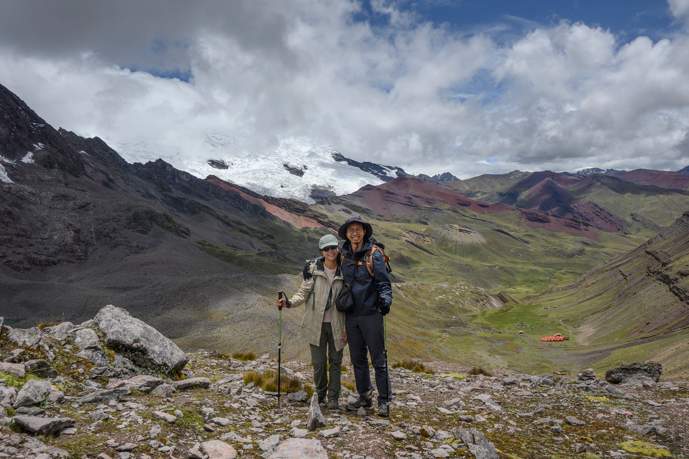
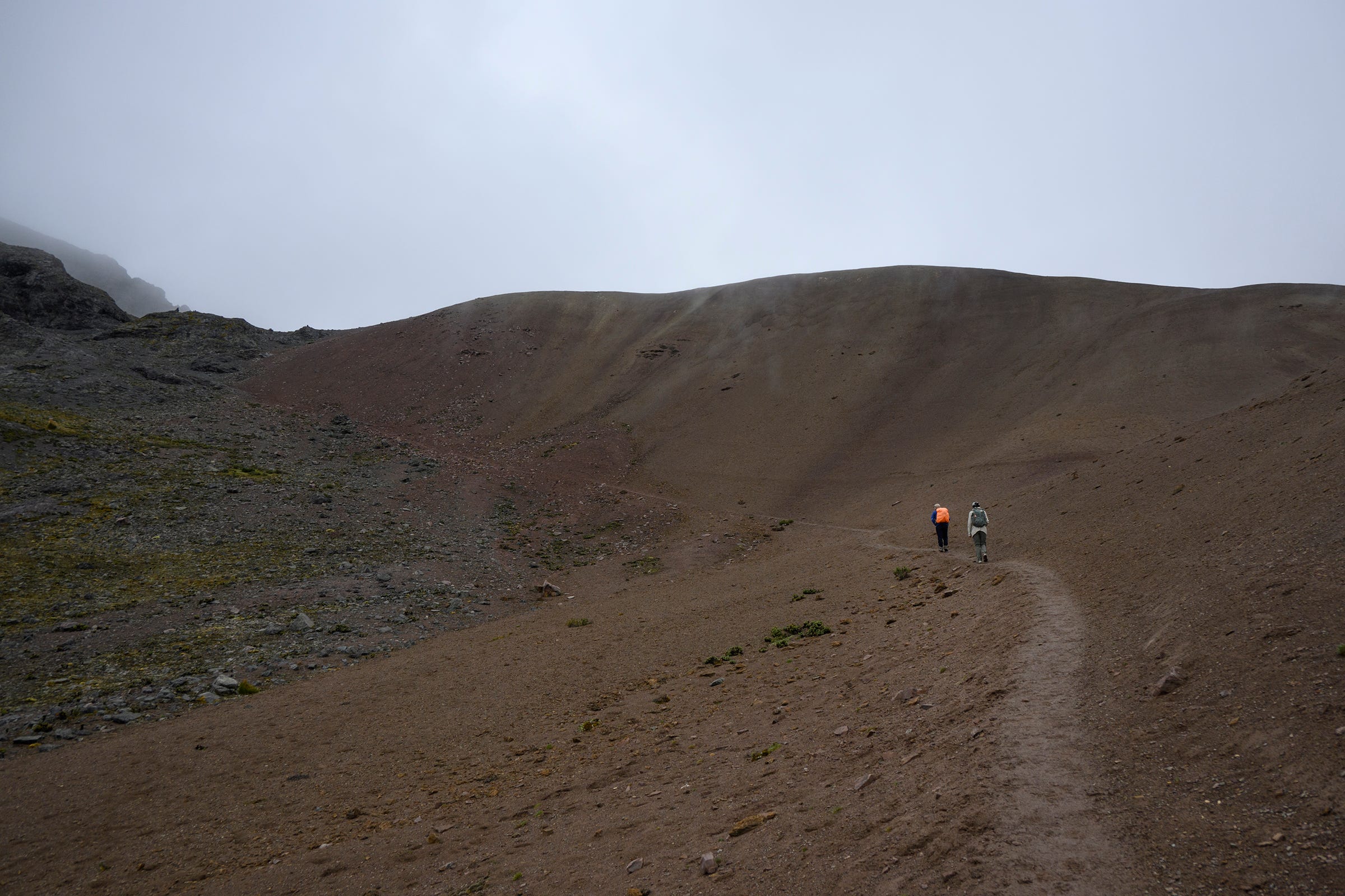
We started the fourth day immediately with an ascent from the Ausangatecocha campsite (4,500m) to Palomani Pass (5,200m), the highest point along our five-day trek.
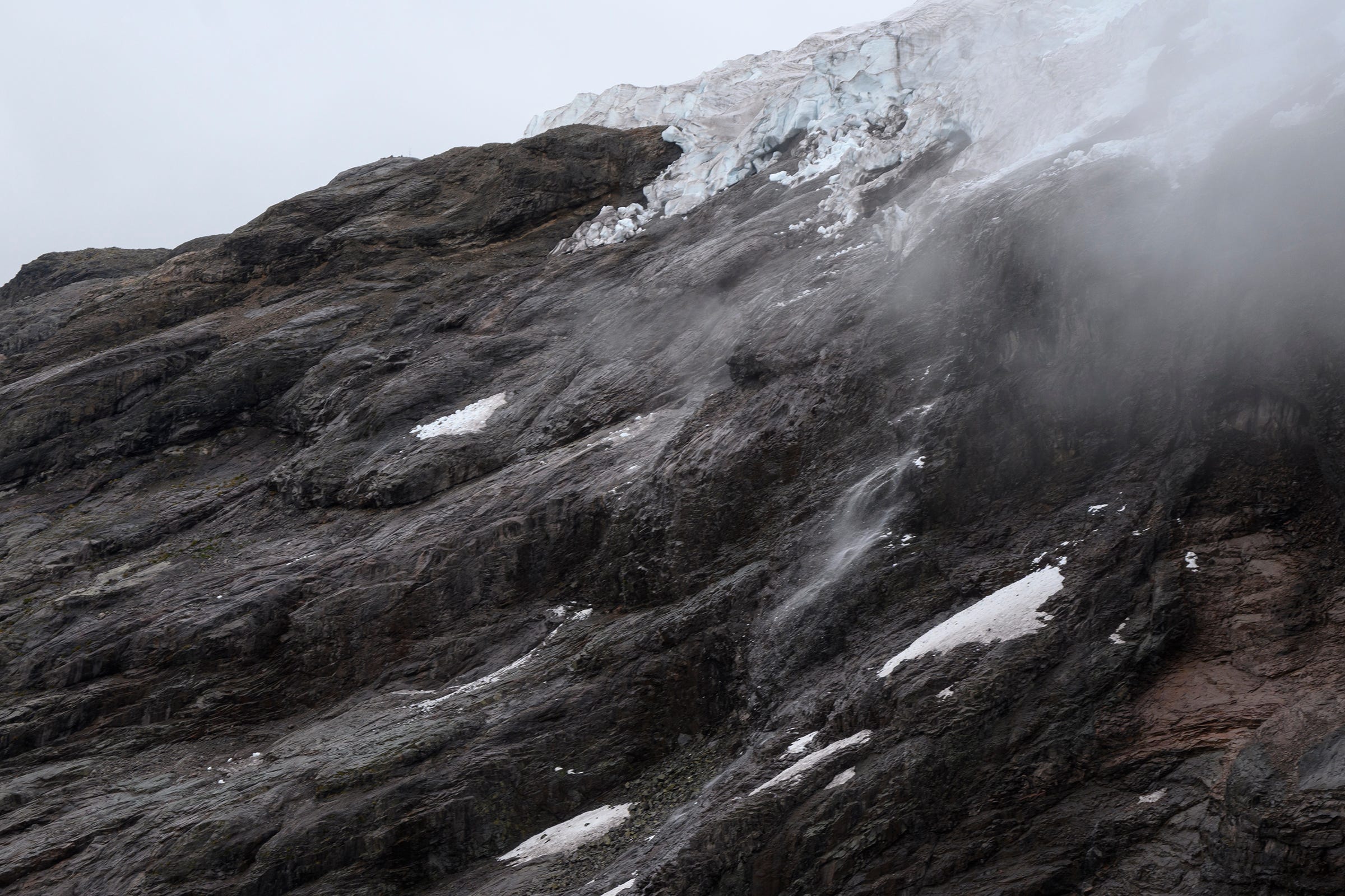
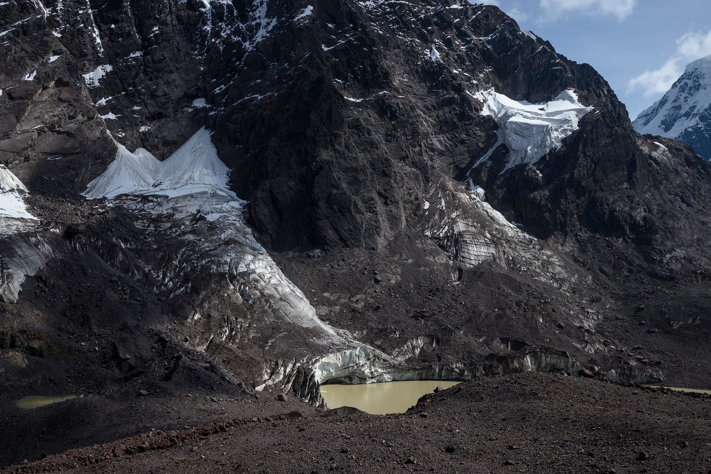
Midway through our ascent to Palomani Pass, we managed to witness some calving of the glacier over Ausangatecocha. We were alerted to this after hearing the distinctive cracking sound of the glacial ice breaking, which some have dubbed as “white thunder”.
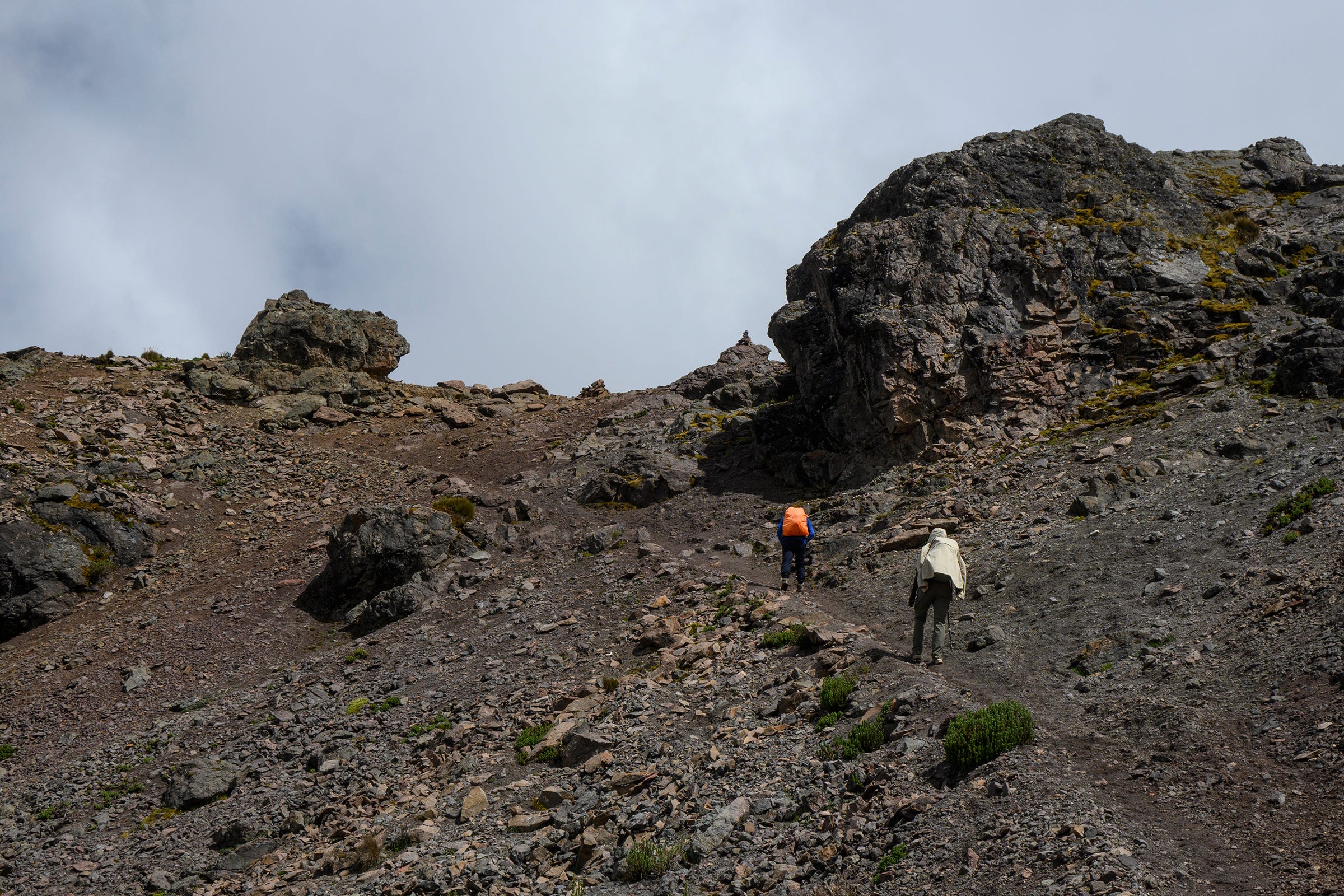
The final stretch to Palomani Pass, which can be seen in the top-left of this photo. At this point, the air was so thin that every step forward would send my heart pounding and require me to take deep breaths. Nevertheless, with a slow, steady pace, we all made it up the pass without a problem, and Richard even commented that we scaled the pass faster than expected, taking 1.5 hours rather than the usual two hours.
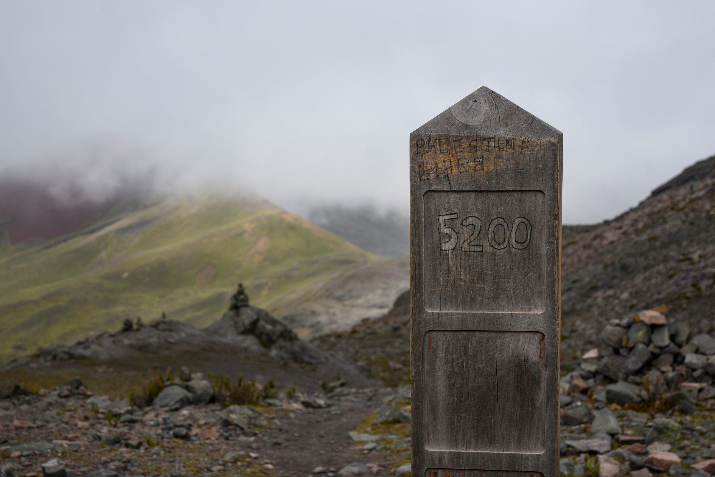
A sign at Palomani Pass marking the elevation in meters.
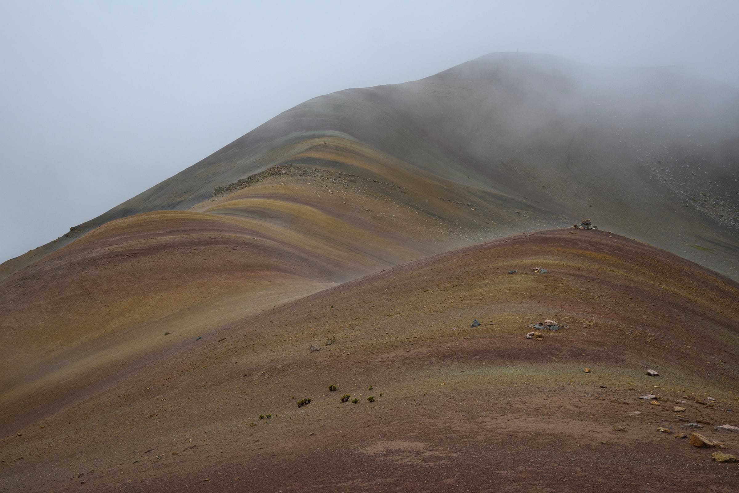
Similar to Vinicunca, one can see layers of differently-coloured rocks around Palomani Pass too. Unlike Vinicunca, however, we had these rocks all to ourselves, with not a single soul in sight.
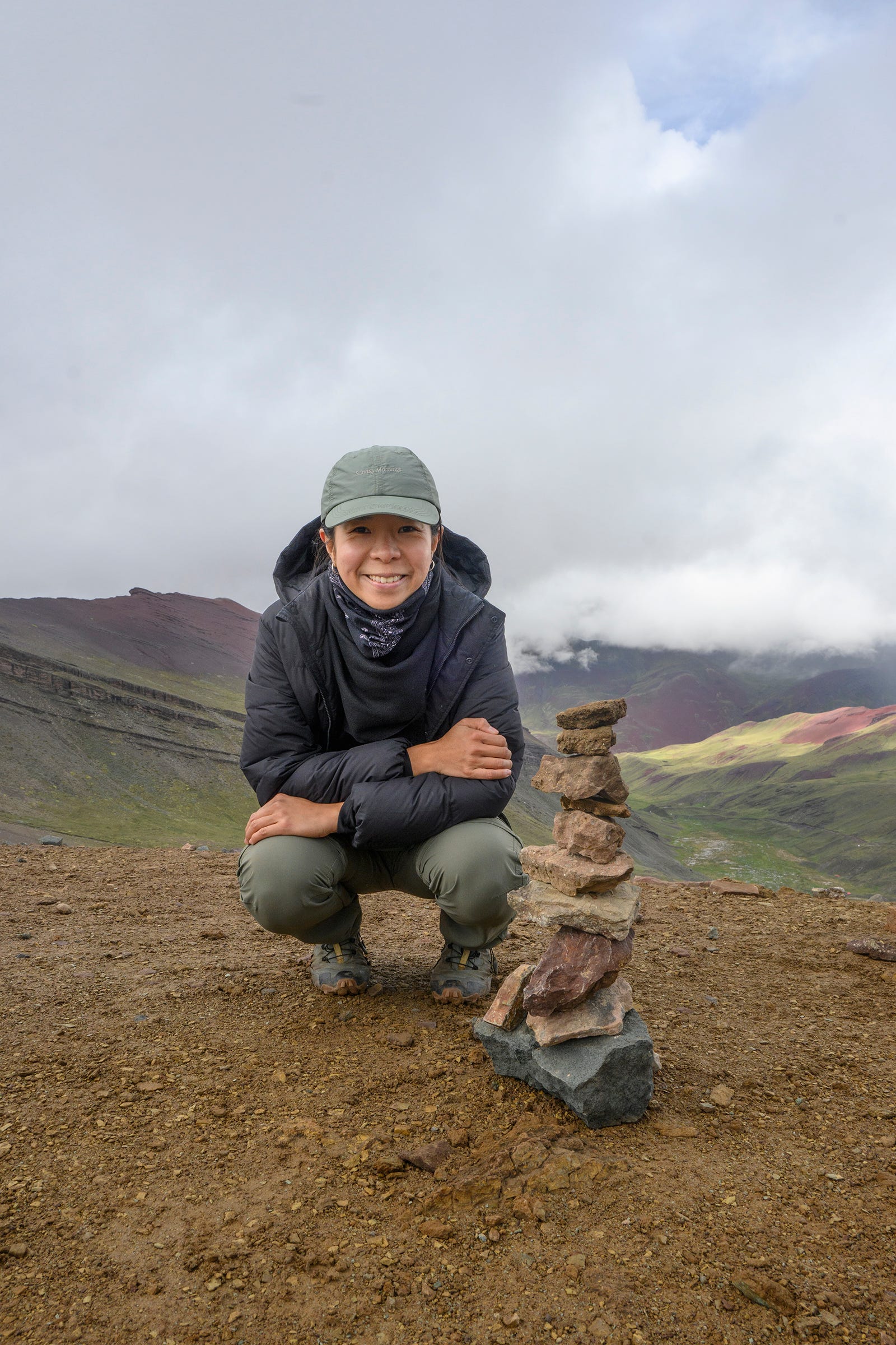
Adelle with the small apacheta she built at Palomani Pass. Apachetas are mounds of stone erected by the indigenous people living in the Andes as a form of offering to Pachamama (a goddess in Incan mythology representing “Mother Earth”) or other deities that inhabit the mountains, known as apus. It is common to see many apachetas at mountain passes in the Andes.
We started to descend from Palomani Pass as it started to rain and snow there. The first landmarks we saw on the way down was Chocolate Lake, which got its name due to its brown-coloured waters.
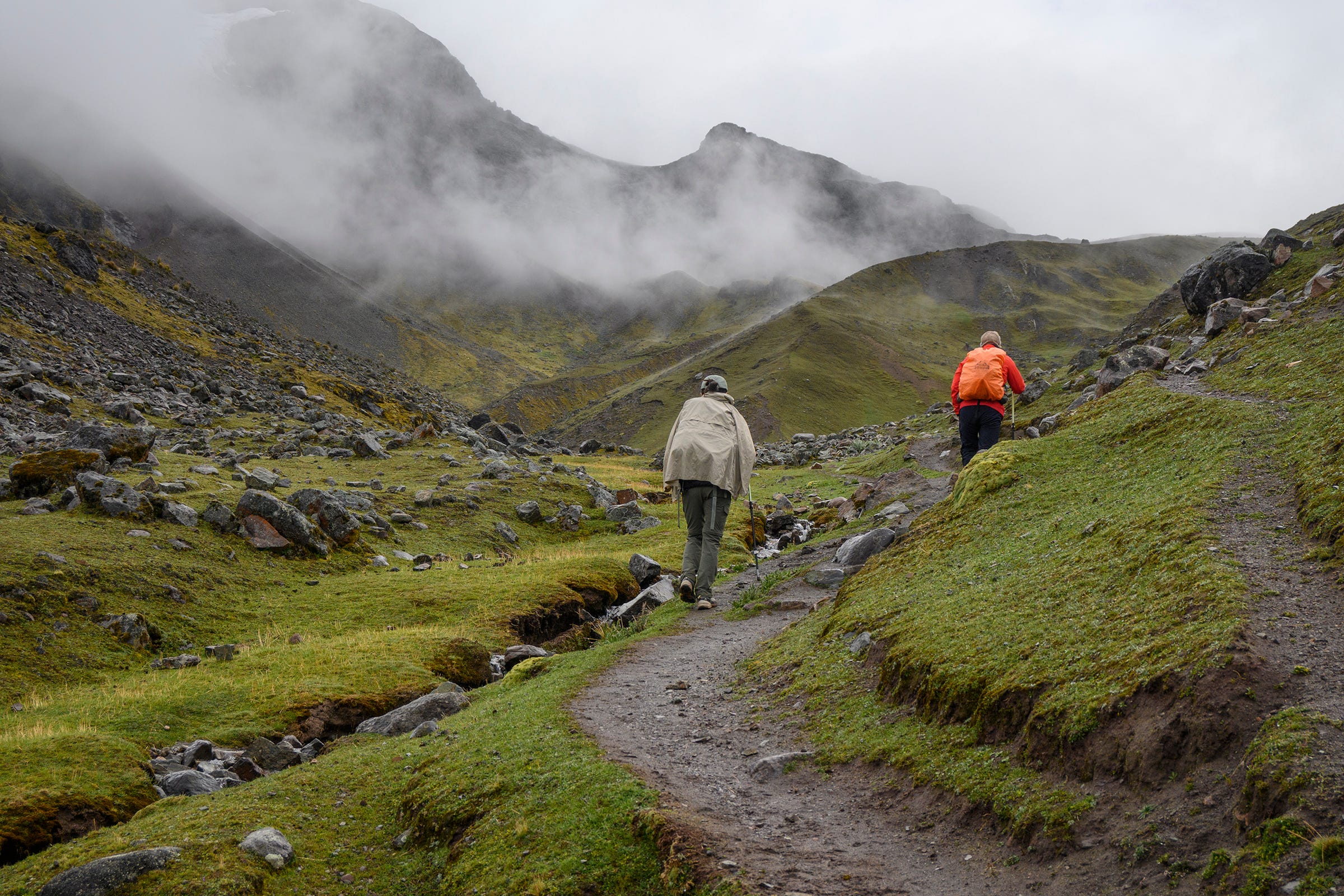
We continued to enjoy stunning views as we descended from Palomani Pass. I took this photo of Richard walking ahead of us, his figure providing a sense of the sheer scale and immensity of the landscape.
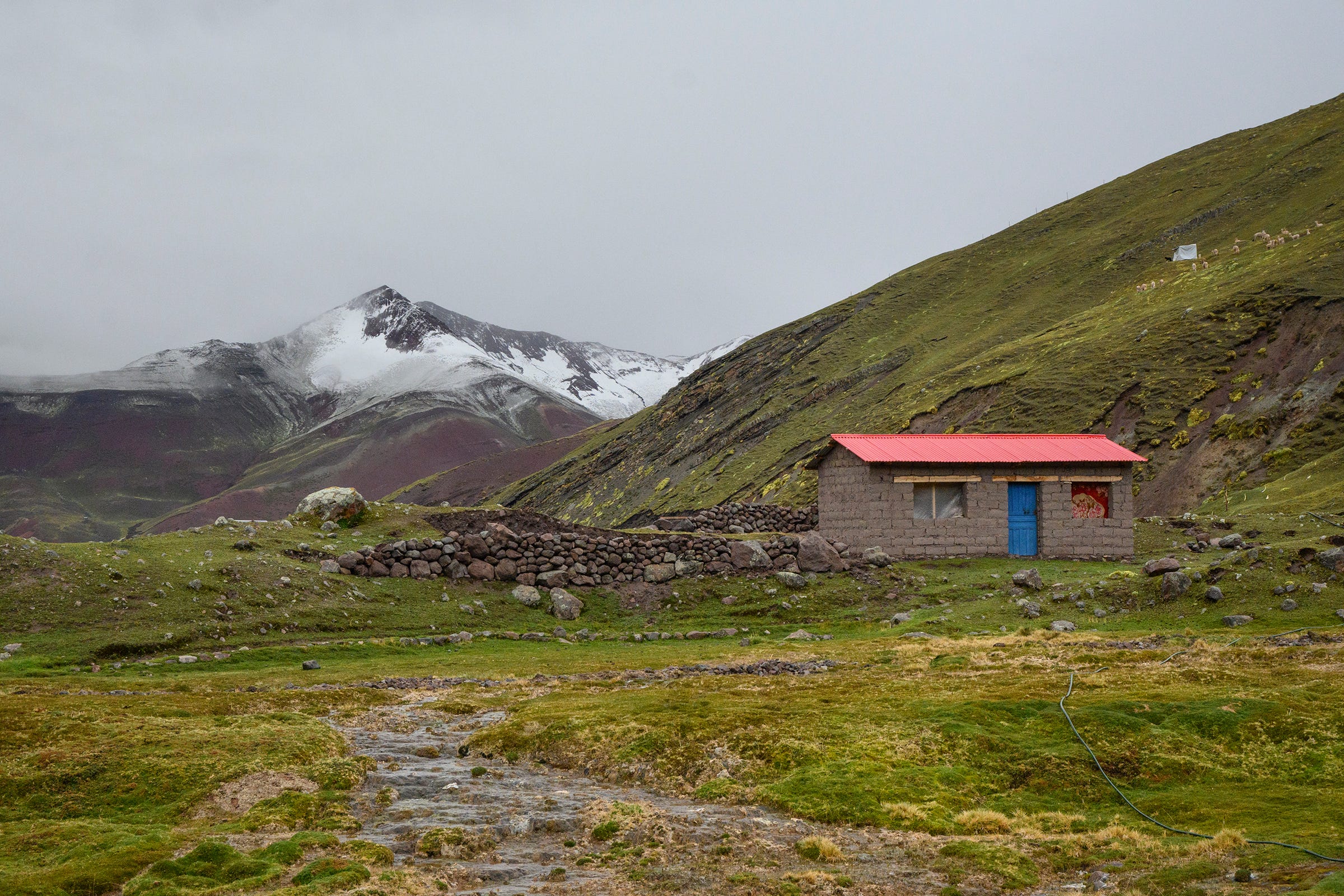
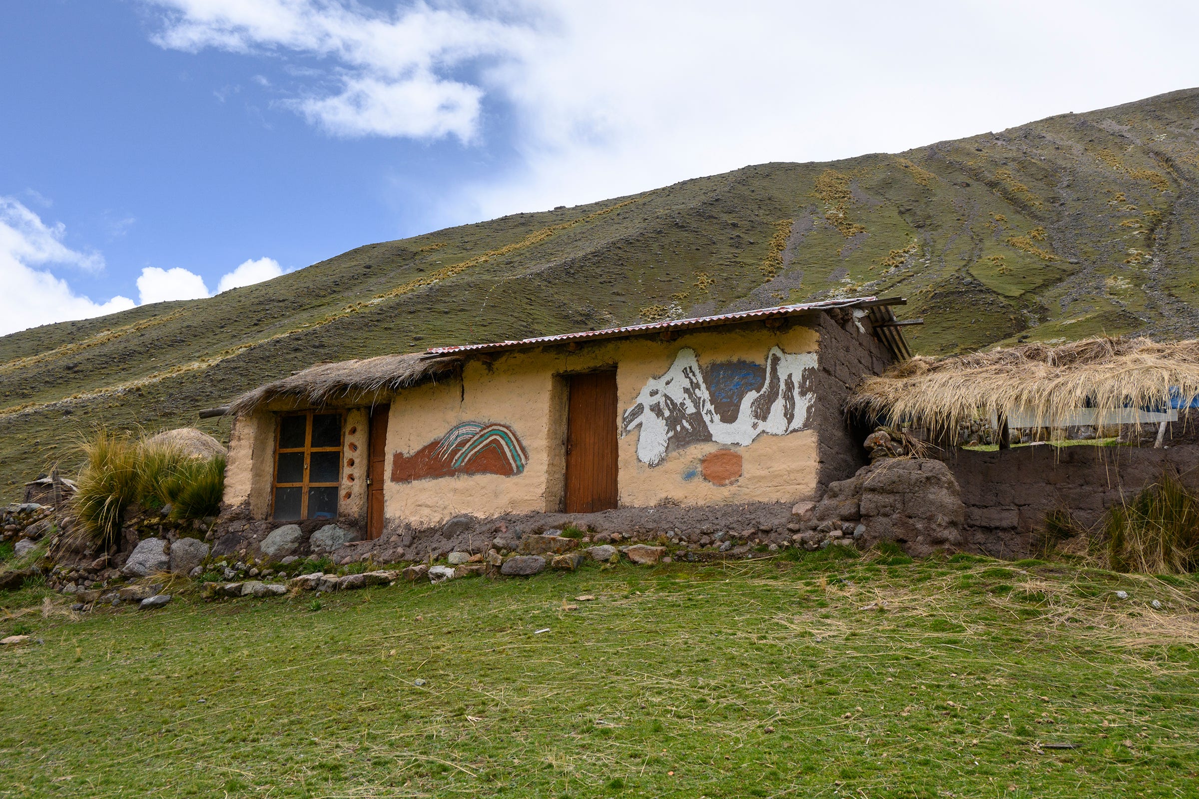
One of the many houses we passed by during the trek. This one has some nice paintings depicting what I believe to be Ausangate (right) and Vinicunca or Palomani Pass (left).
I noticed that alpaca poo seemed to be always found in large clusters (see photo on the left for example). I asked Richard why, and he said that the alpacas just seem to have a natural instinct to poo in the same spots. Their poo, after being dried, serves as an important source of fuel for the indigenous communities living in the Andes.
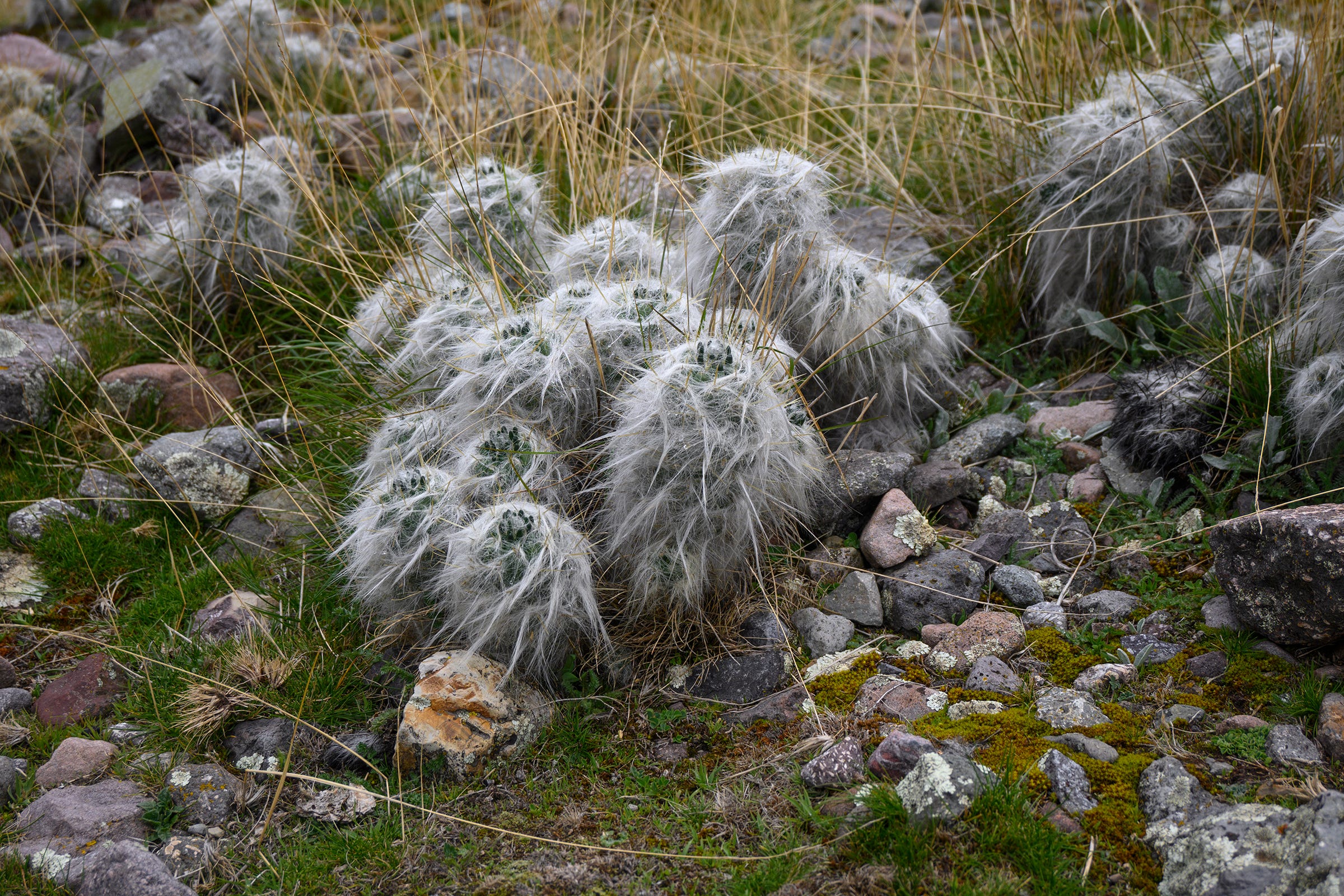
We saw lots of these cacti with fluffy white hair along the trail. After some post-trek research, I think they are Oreocereus celsianus, which are colloquially known as the “old man of the Andes” due to their white hair. Richard said that these cacti can be used to treat fevers.
Given that we were trekking during the start of the rainy season (and that it rained every single day), the rivers and streams we walked past naturally had strong flows of cool and clear water.
One of the many waterfalls we walked past during our trek.
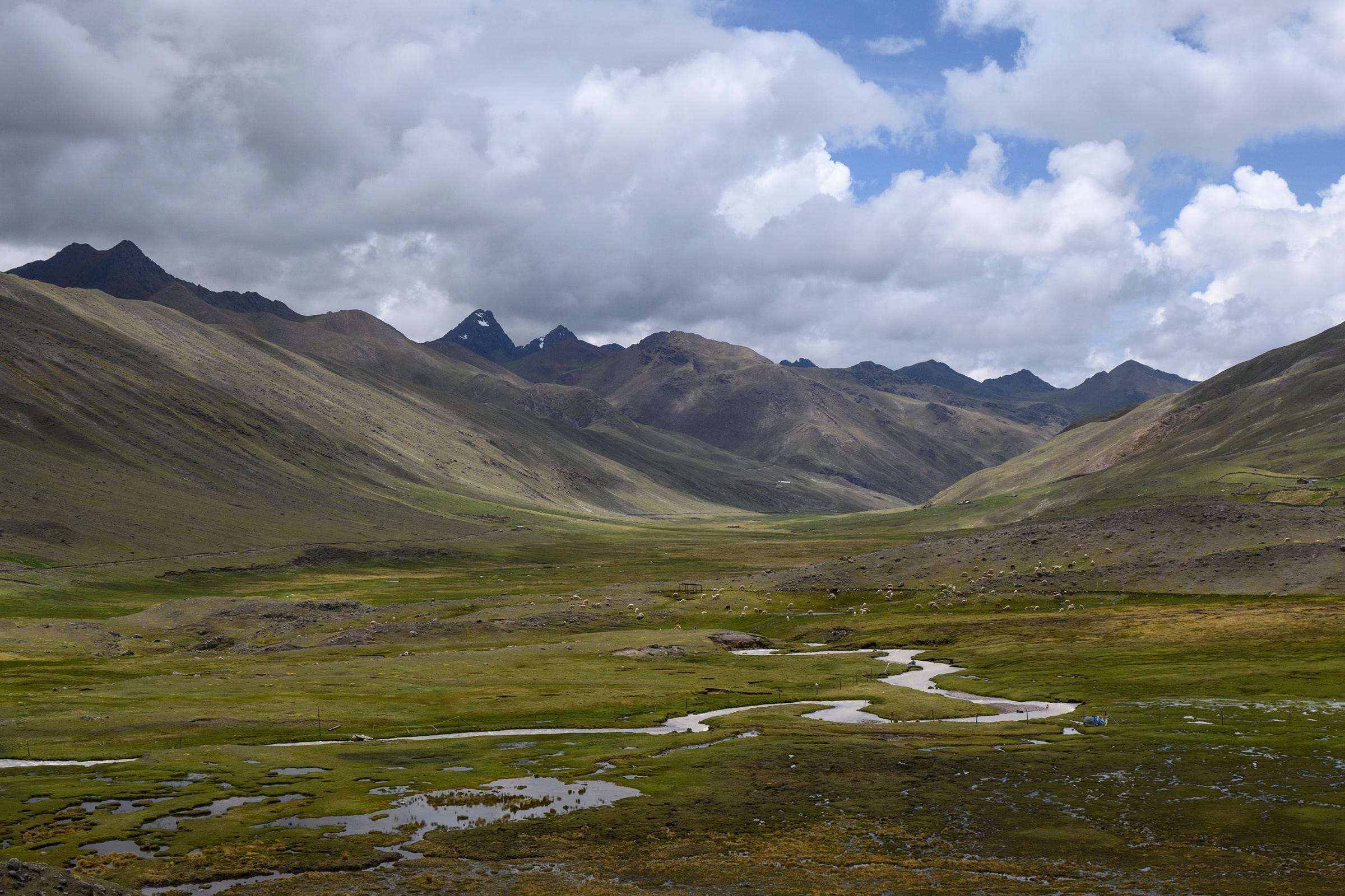
A meandering river we saw on the way to our fourth and final campsite at Qampa.
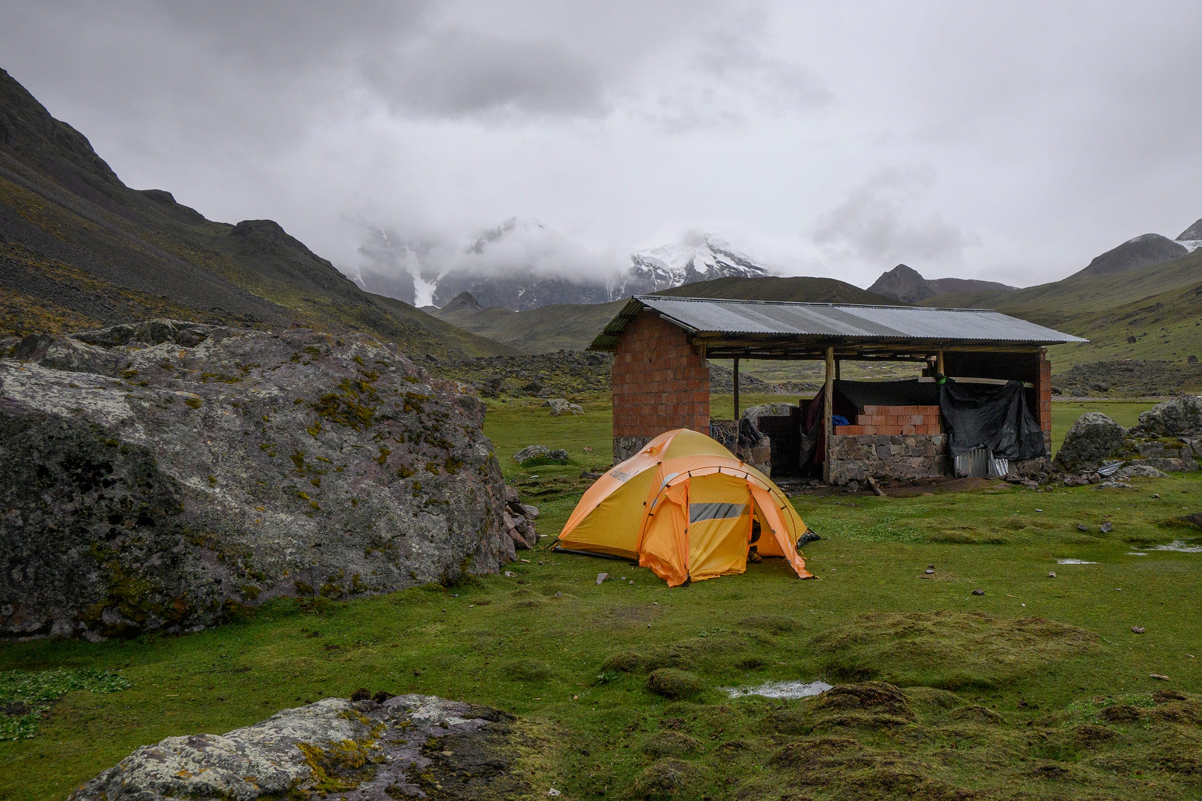
Our tent at the Qampa campsite (4,700m).
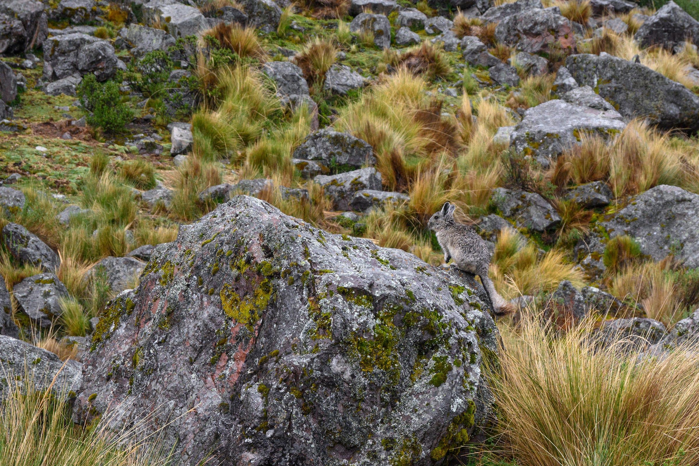
From afar, these little mammals looked like chinchilllas. Upon closer inspection, however, they should be viscachas—a type of rodent native to South America, especially in the Andes. We saw many of them hopping from rock to rock at the Qampa campsite.
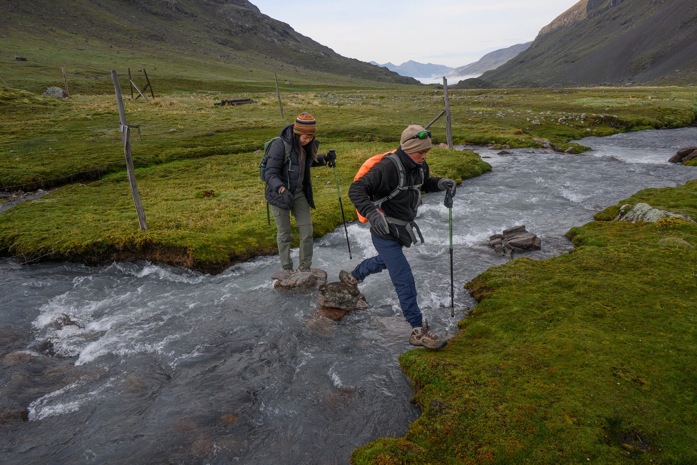
We had to cross numerous streams throughout the trek. Thankfully, there were always strategically-placed rocks in the water to allow us to cross without having to wet our boots.
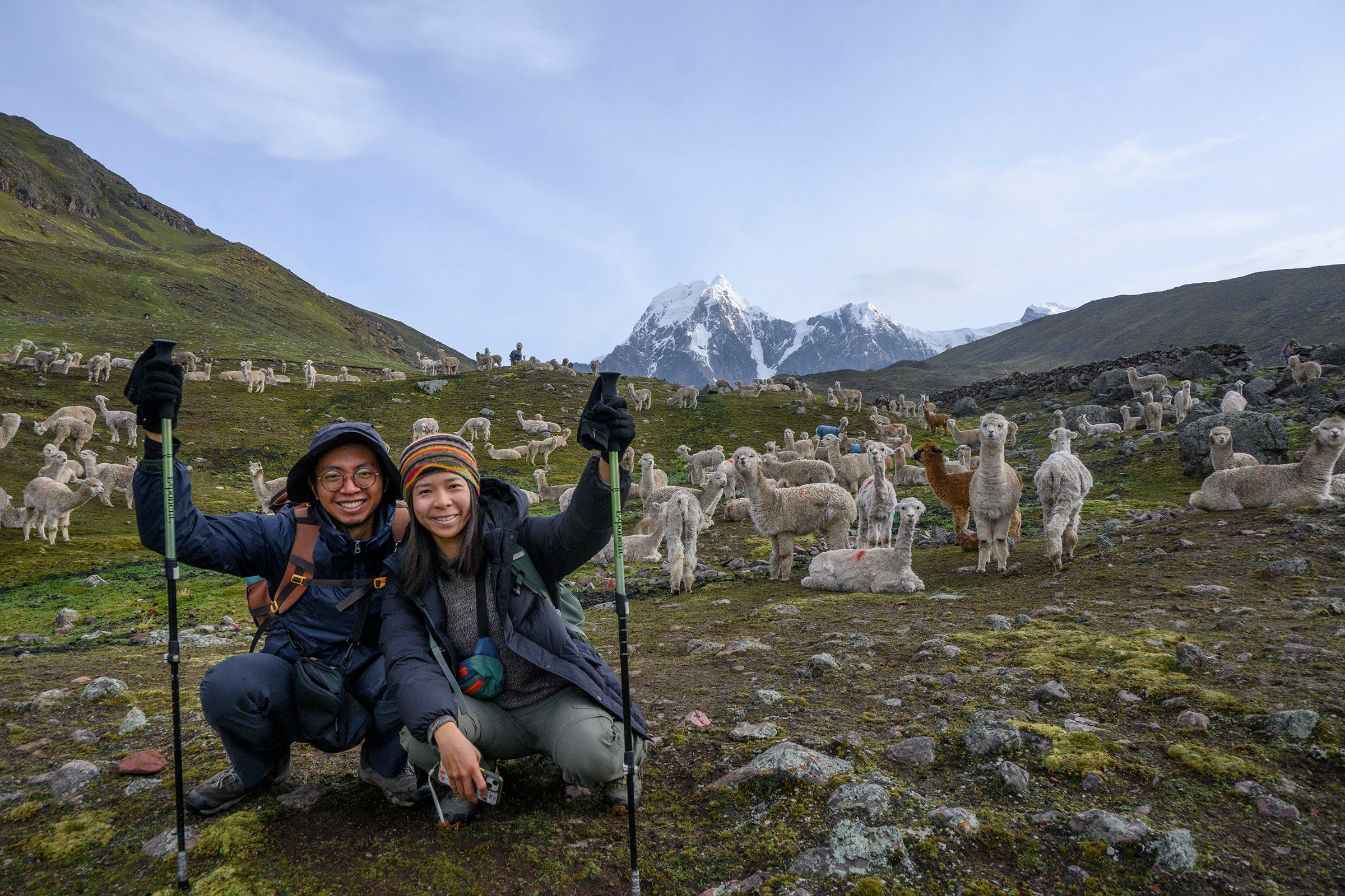
Stumbling upon this herd of alpacas on the final day of our trek, we just had to take a photo with these cute, cuddly creatures!
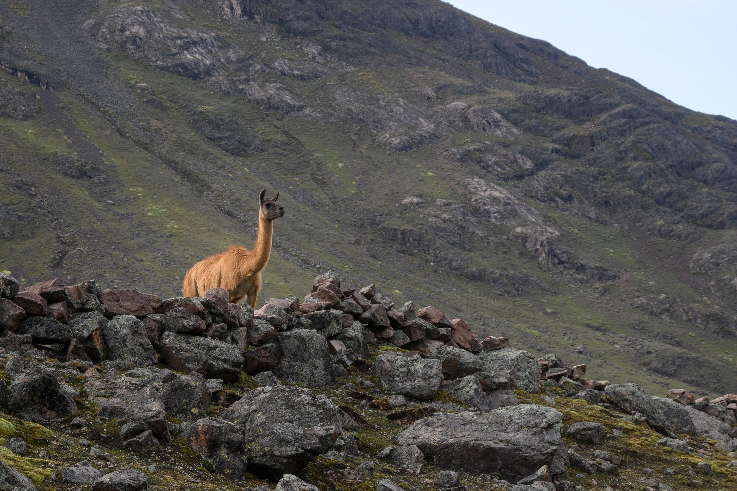
We also managed to see llamas on the final day of our trek. Both llamas and alpacas are camelids native to the Andes. Llamas are the largest camelids in the Andes and are generally used as pack animals to carry supplies through the mountains. They can be differentiated from alpacas on account of their larger size, longer neck, more elongated faces, and pointed ears.
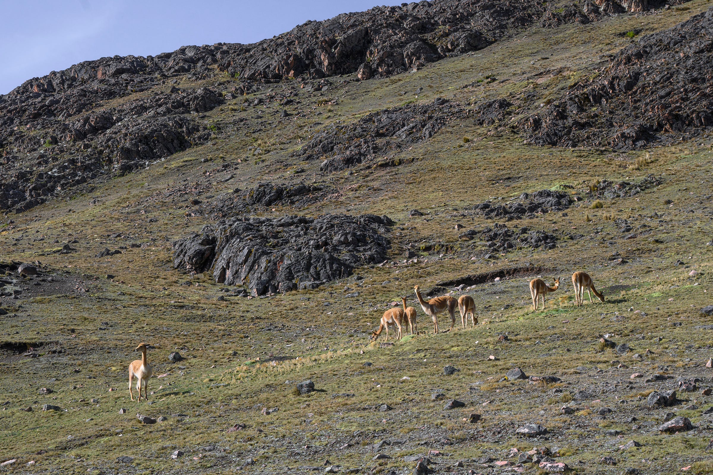
Richard said that we were very lucky to be able to see vicuñas along the trail. Unlike its camelid cousins, the alpacas and llamas, which are domesticated, vicuñas live in the wild and are an endangered species. Vicuña wool is extremely fine and especially costly because their coat takes as long as three years to grow back after being sheared and they have to be caught from the wild.
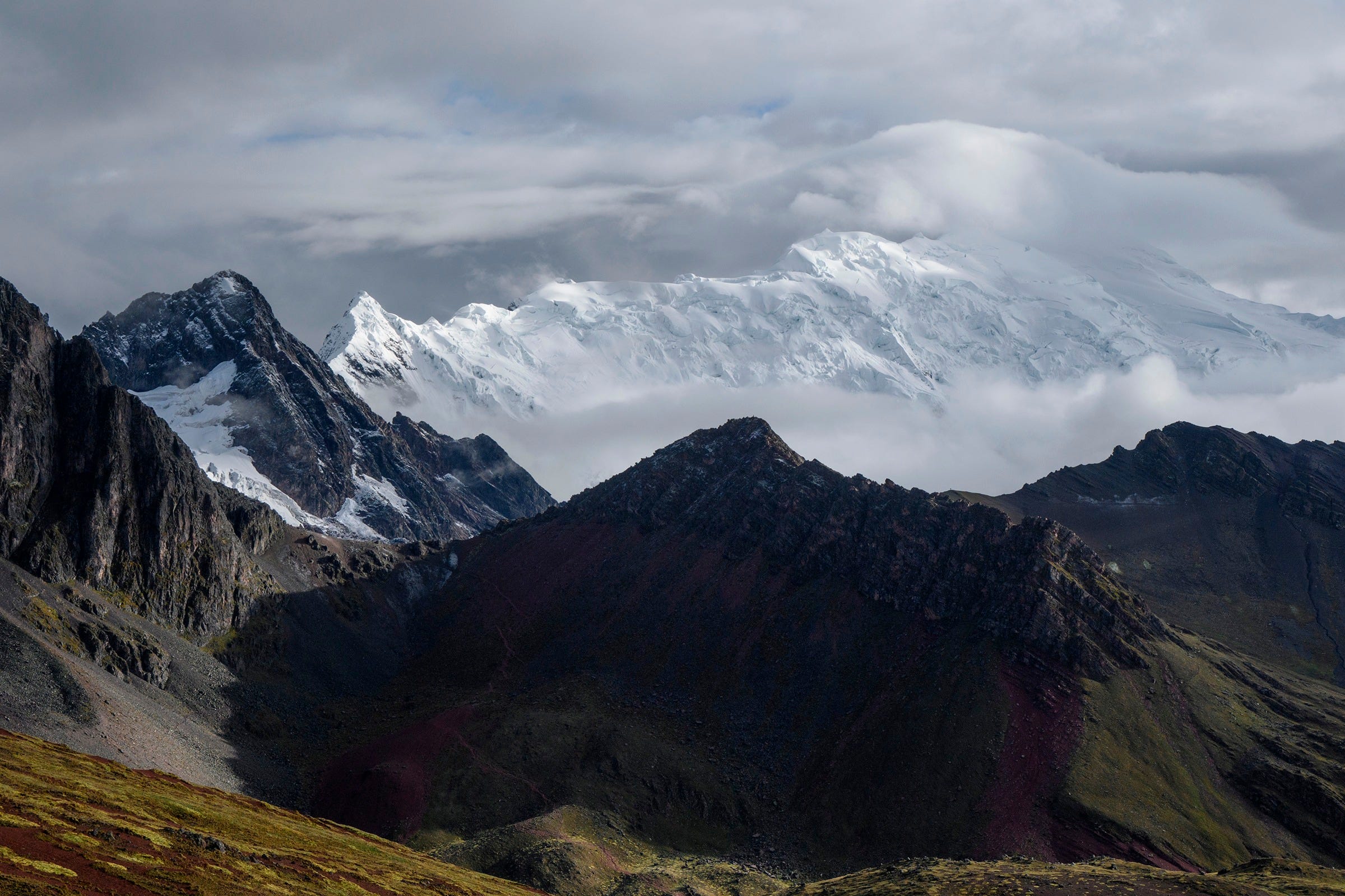
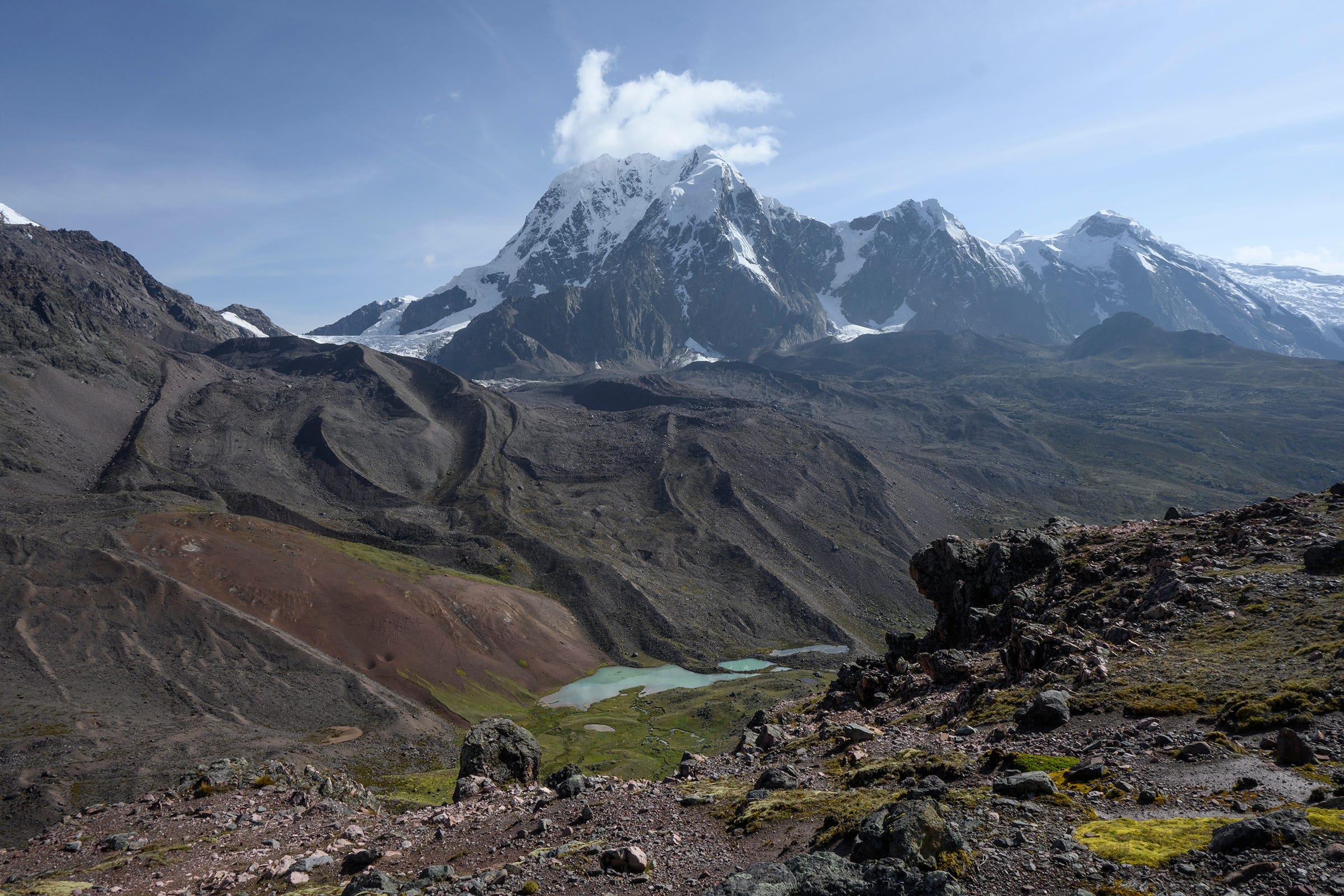
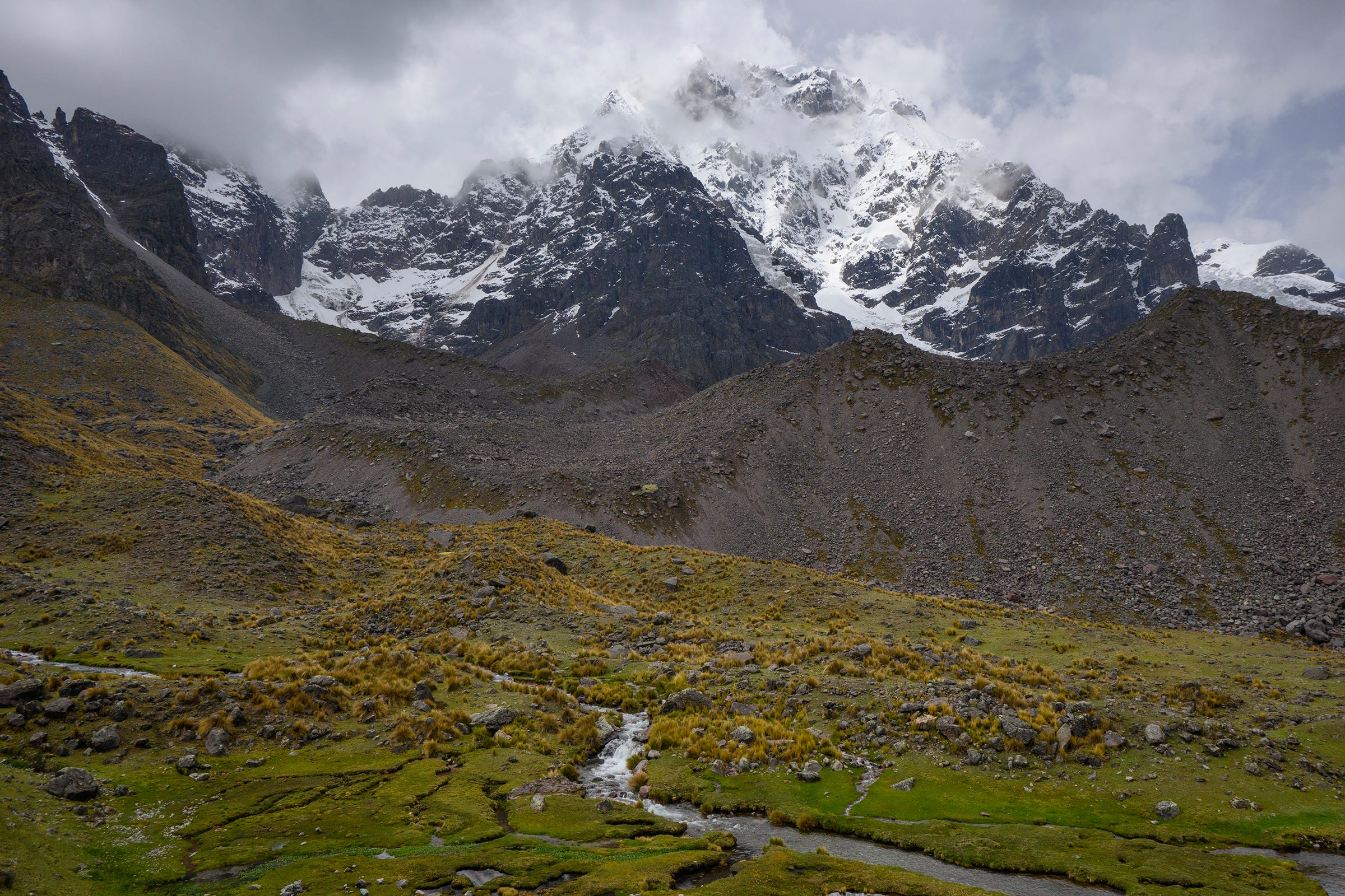
More scenic views of mountains, glaciers and lakes as we made our ascent to Qampa Pass (5,070m), the last mountain pass on our trek, on our fifth and final day.
On our ascent to Qampa Pass, we had great views of Nevado Santa Catalina (5,808m) and its glacier. Richard said that the locals called this mountain, “la montaña del diablo” (mountain of the devil), because they could often hear strange shouts from the mountain late at night. With this in mind, I couldn’t help but notice an uncanny resemblance of a face at the side of this mountain, with its two small glaciers on its side and a small lake at the bottom when seen from Qampa Pass.
The view from Qampa Pass, to the right of Nevado Santa Catalina.
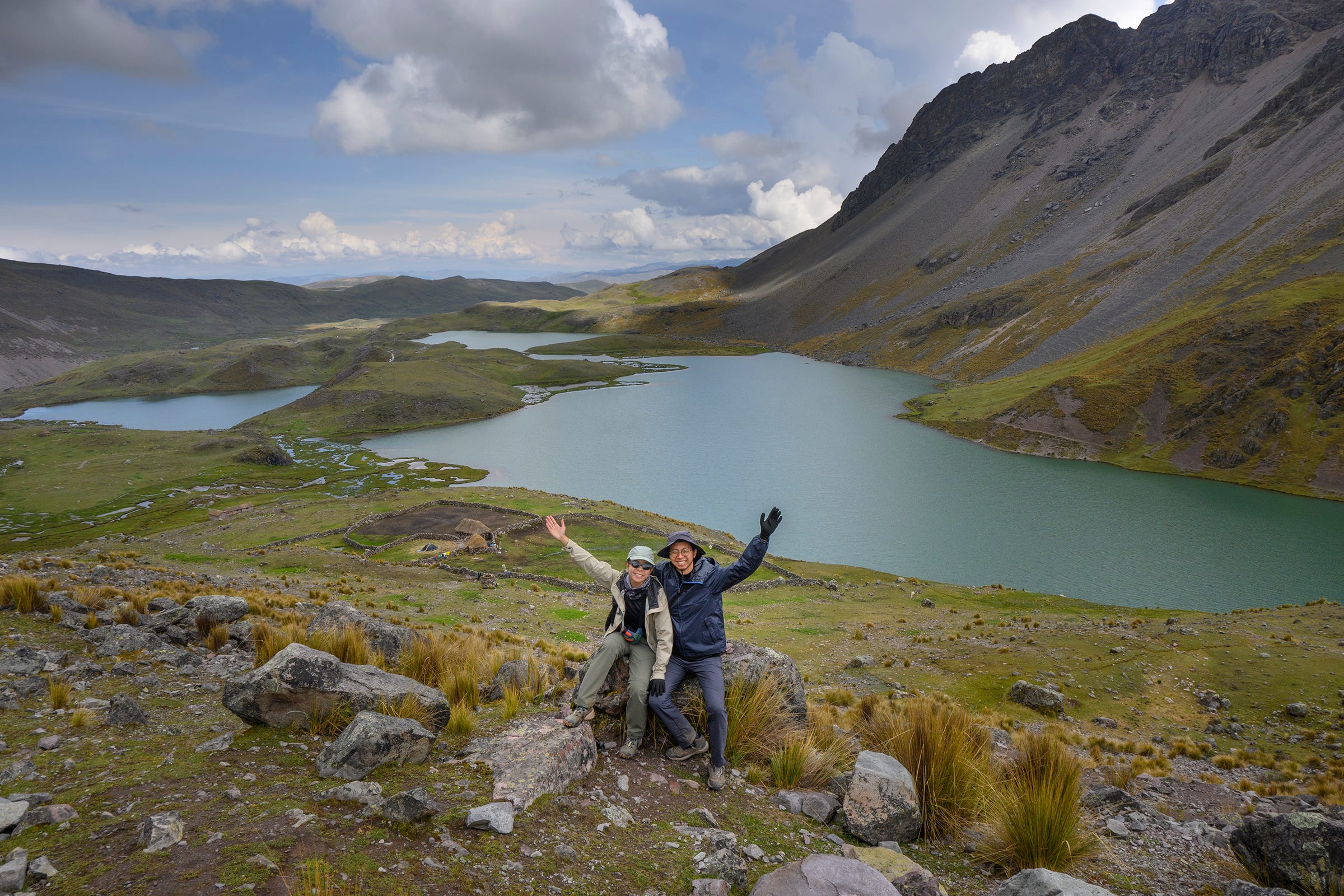
After descending from Qampa Pass, we continued on to the Seven Lakes, a cluster of beautiful lakes north of Ausangate.
We saw this baby alpaca while walking past a local’s home at the Seven Lakes. Richard said it was likely born the day before, making it only about a day old!
We got impressive views of Ausangate from the Seven Lakes, even as it remained obscured by clouds.
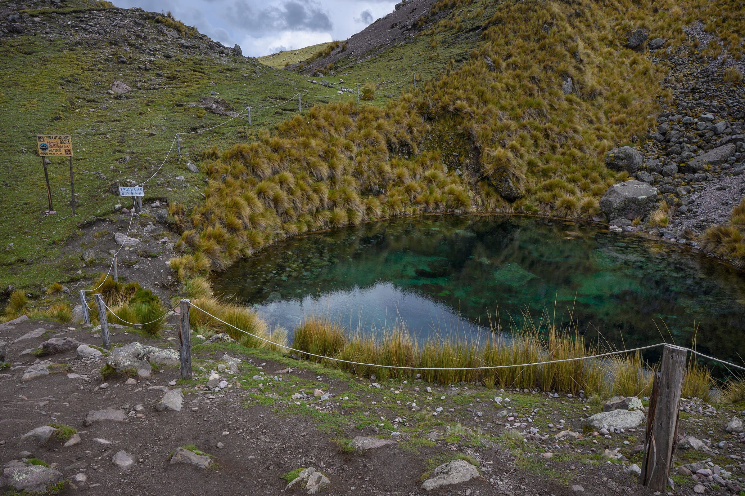
Of the Seven Lakes, this small one—China Uturunku Qocha—was the prettiest in my opinion, with its clear, turquoise-tinged waters and shallow depth allowing one to see the submerged rocks underneath. It reminded us of some of the cenotes we saw in Mexico.
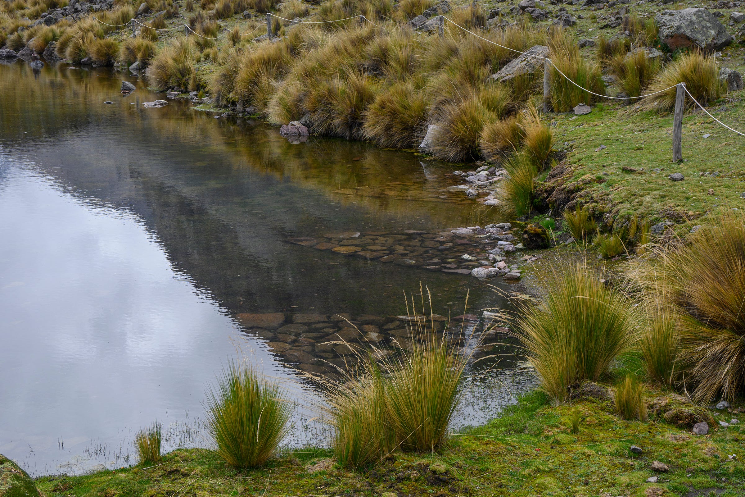
Richard explained that the trianglular-shaped stone platforms in this lake—Chuñu Qocha—was used to sacrifice alpacas, specifically black-haired ones, during a local religious festival held in the middle of year. This festival could be the Inti Raymi, which was a religious ceremony held by the Incas to celebrate the winter solstice (June in the Southern Hemisphere) and to honour their sun god (Inti). Although this festival was banned by the Spanish during the colonial period, it was revived by the inhabitants of Cusco in the mid-20th century to reconnect with their heritage.
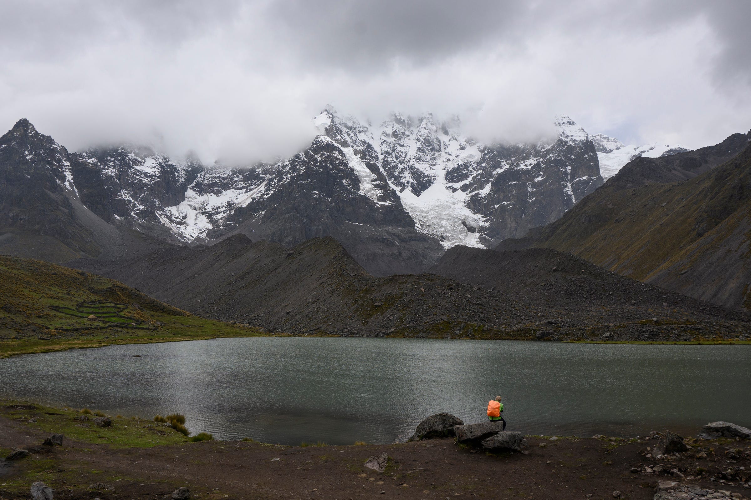
Richard admiring the view of Anqas Qocha while waiting for us to pee behind a stone wall. During the dry season, I would imagine that one can get impressive views of Ausangate from here.
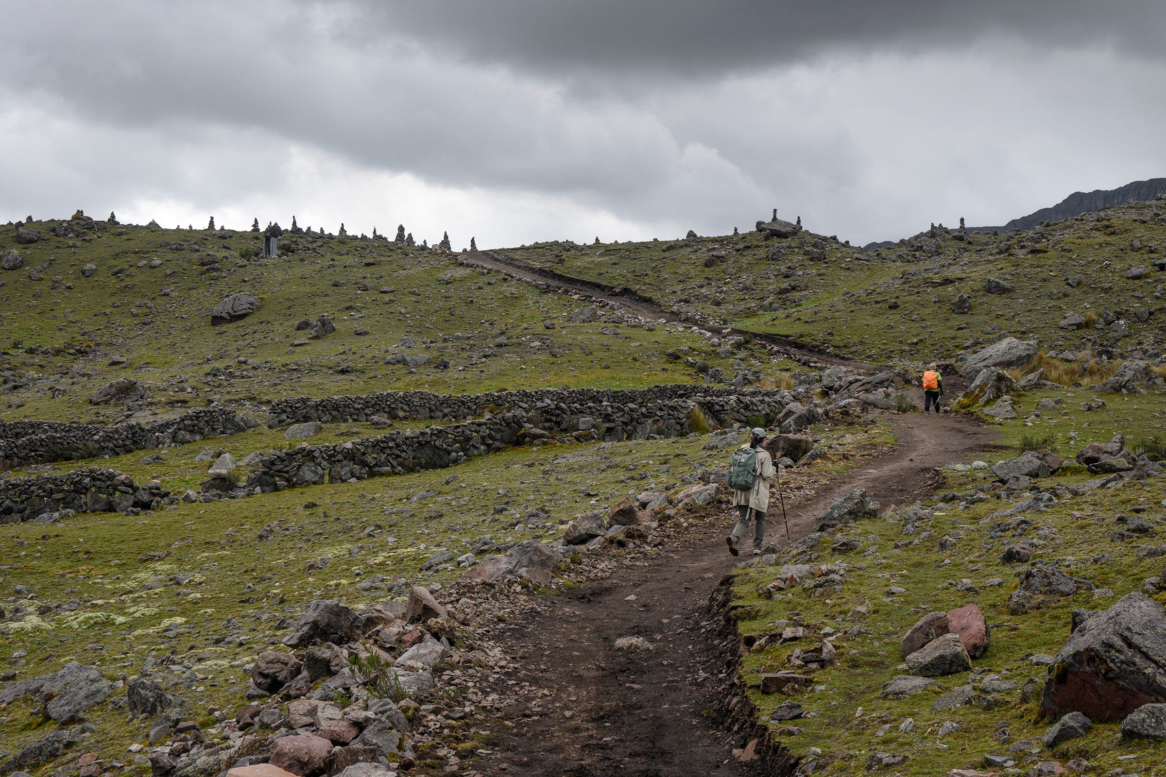
From the Seven Lakes, we headed towards the final destination of our trek, the community of Pacchanta. Along the way, we passed through this small ridge with a long row of apachetas that could be discerned from afar.
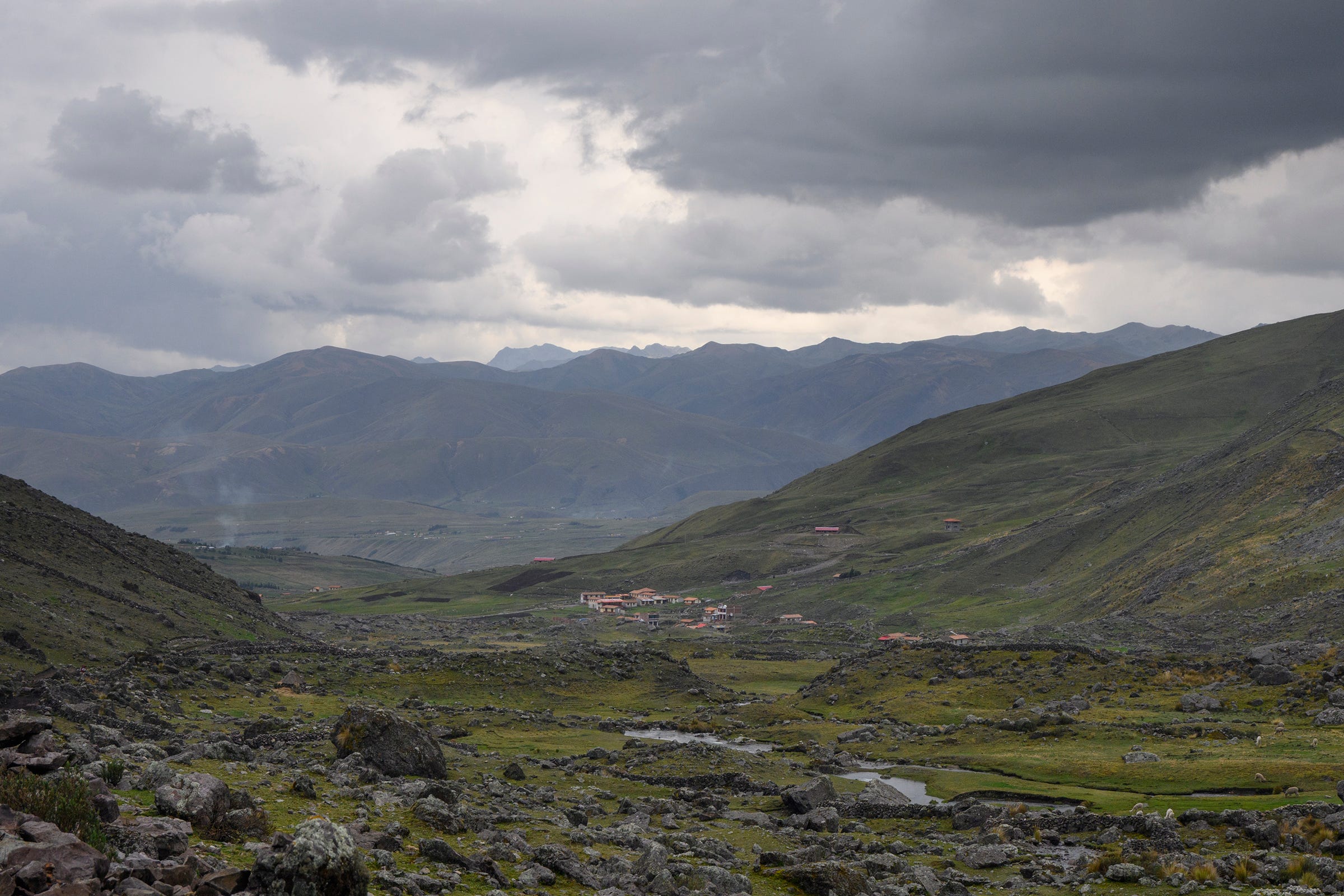
First sight of Pacchanta—the end was near!
Left: A wefie to commemorate the end of our trek in Pacchanta. We thought that we had reached Pacchanta before Juan and Wilber as we didn't see them on the trail, but it turned out that they took a shortcut and were already in town. Right: Enjoying the public hot springs at Pacchanta, the perfect way to relax our tired muscles after trekking 70km and scaling numerous mountain passes over five days. During the dry season when it is rarely cloudy, one can also see Ausangate from the hot springs!